


")
")
")
")
")
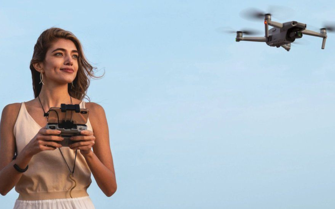
As a drone pilot or operator, one of the most important things to do before each flight is to check where you can and cannot fly the aircraft, checking geographic zones before taking to the skies. Make sure you enjoy your flight or a good day of work with your drone without getting into trouble by entering an unauthorized flying zone, which could result in serious fines or cause accidents.
According to ANAC
Geographic areas will be established for reasons of operational security, security against illicit acts, privacy or environmental protection. The geographical areas established in Portuguese airspace are available at https://uas.anac.pt/registry/explore, and the operator can also consult the areas in KML* format here, as well as in JSON format according to the ED standard -269 here. UAS operators operating in Portuguese airspace must consult the established areas before starting the operation. Areas can be unloaded by operators for the purposes of pre-tactical planning and use during the operation.
Find out more about Geographic Zones and Airspace U directly on the ANAC website: https://www.anac.pt/vPT/Generico/drones/zona_proibidas_condicionadas/Paginas/Zonasproibidasoucondicionadas.aspx.
You can also download the ANAC application, VOA NA BOA. ANAC informs that an update to the application is available, in the iOS version and soon in the Android version, adjusted to current European regulations regarding drones, for use by operators of unmanned aircraft in the open category. In addition to updating the rules, the map system was updated.
Drone geographic zones (UAS)
To keep aircraft and people on the ground safe, geographical zones, or geozones, have been created across Europe by various states. Geozones are parts of airspace where drone operations, or, to use the more official term, “unmanned aircraft system” (UAS), are facilitated, restricted or excluded. Geozones are established to:
- Minimize security risks.
- Protect the privacy of others.
- Address security concerns.
- Address environmental concerns.
Red: Excluded geozones. Flights are prohibited for operations in all or certain classes, therefore flying drones is not permitted.
Yellow: Restricted geozones. UAS operations are limited and are subject to compliance with the set of conditions imposed in these areas. You need prior authorization to fly your drone as it may be close to areas such as airports, heliports, national parks, military installations, hospitals, nuclear power plants or any type of key industrial zone, etc.
Green: Geozones made easy. UAS operations are facilitated in the “Open” category, so you can fly your drone.
Blue: Airspace designated “U Space”. A part of the lower space where operations for drones and other vehicles operating in it are managed.
There are three main geographic zones for which Member States can adopt a color code to ensure that airspace users can quickly identify which zone they are referring to.
Flight zones – restrictions on altitude, time, distance.
You may come across areas where flight restrictions apply or where you are simply not allowed to fly your drone, such as a low-level flight zone for the military. There is also the possibility that, in some areas, partial restrictions may be applied, such as:
- It is only allowed to fly the drone below a certain altitude, defined below the maximum of 120 meters allowed by the rules in the open category.
- Flying the drone is only permitted during a specific period during the day, for example because an event is taking place nearby, such as a concert or a sports game.
- The horizontal distance between you and the drone can be reduced.
An aeronautical chart provides precise information about the area in which you intend to fly and its restrictions. Google Maps can also be a source for a quick inspection of the area in which you intend to fly.
Find out everything about Geozones, step by step and where to fly your drone directly on the EASA website: https://www.easa.europa.eu/pt/light/topics/geo-zones-know-where-fly-your-drone.
Contact us for questions, purchase or drone training!
When the drone flies away (Flyaway)
Flyaway occurs when the drone loses connection with the pilot’s controls and simply flies uninterrupted. This also happens in combination with a loss of GPS signal, whereby the “Return To Home (RTH)” option cannot be initiated.
This is a type of incident that drone operators must report, regardless of the area in which they fly, namely:
- To the national aviation authority of the country in which it operates.
- If you are granted permission to fly near a controlled airport or flying zone where drone operations are restricted, you also need to immediately inform air traffic control with information about the drone’s path, altitude, the speed and (if possible) the remaining battery charge.
- To your insurance company.
How to avoid flyaway. Safety tips.
- Calibrate the compass before each flight;
- Wait for the drone to record the Homepoint before starting the flight;
- Configure in the application the altitude of the RTH (Return To Home) and the return to the homepoint in case of loss of signal;
- Avoid flying close to places that can generate a lot of interference (metal, glass, etc.);
- Avoid BVLOS flights;
- Make sure that the drone and control firmware are always up to date;
- Make sure the batteries are properly charged enough for the planned duration of the flight;
- Make sure you have enough altitude to avoid any obstacles.
DJI drones and flight rules
However, except for the rules imposed by the competent authorities, if you are using a DJI drone, some limits are imposed and developed with this scenario in mind, in order to significantly increase operational safety. DJI has implemented areas in which it is not allowed to fly its drones at all, which can be viewed in the drone flight app or on DJI’s own GEO ZONE MAP website. In these cases, if you are within the stipulated perimeter and after finding the minimum number of satellites you will not even be able to start the engines, and if you take off before this minimum number, the drone will land at the exact moment. Even so, if you are outside the flight perimeter and try to access it by flight, an alert will be issued in the drone flight application that it will not proceed. This is all for the sake of air safety!
Do you have questions and doubts about when, where and how you can fly a drone? Speak directly to an HPDRONES specialist. We will be happy to help you!
_______________________________________________________________________________________________________________________
