
")


")
")
")
")
")
TRINITY™ PRO
Designed for evolution
Expand your business opportunities with Trinity Pro.
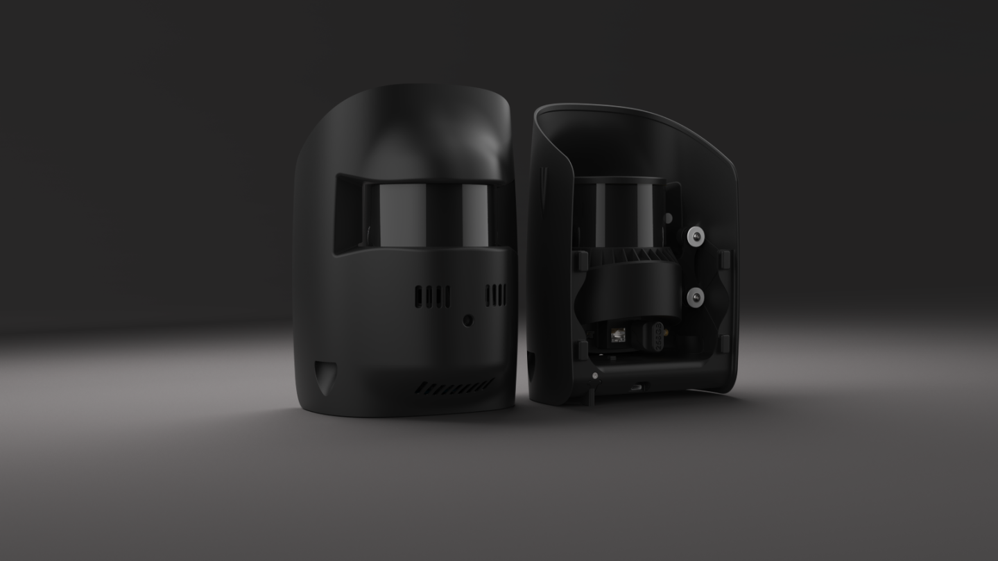
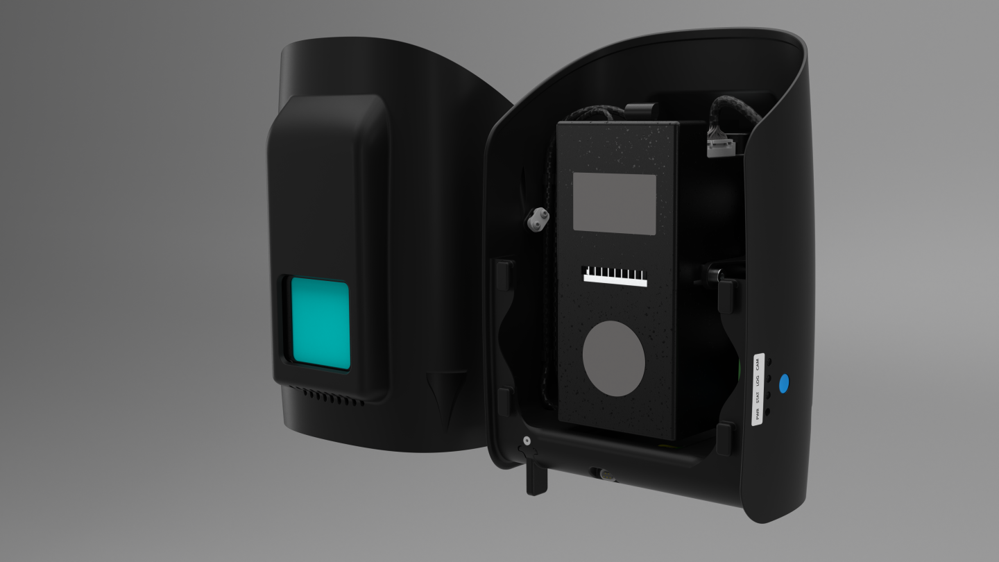
A future-proof mapping solution based on a reliable, easy-to-use and secure platform. It is designed to accommodate needs with evolving capabilities and accelerate decision making using aerial data. As technology evolves, so does Trinity Pro. It integrates the latest Quantum-Skynote autopilot with Linux mission on-board computer. These high-performance products provide increased computing power and internal storage, as well as connectivity and availability on board the UAV.

90 minutes of flight
Quantum-Skynode technology
Advanced self-diagnosis
Easy-to-replace sensors
Certified and compliant
IP55 Rating
Area of coverage: 700 hectares
PREPARED FOR THE FUTURE
Technology such as Quantum-Skynode autopilot and Linux mission equipment. These are integrations that will change the way you interact with data, reducing processing steps and work time, and providing fast and accurate responses.
- Future-proof investment
- Simple and safe operations
- Versatility that enables growth
- High uptime, maximized results


PERFORM MISSIONS WITH EASE
It is easy to use and offers state-of-the-art security features.
Trinity Pro, combined with QBase 3D mission control software, forms a fully integrated system. During field operation, Trinity Pro provides peace of mind to the operator. The Quantum-Skynode flight control unit features the latest safety functions, which ensure that the UAV flies as safely as possible, including automatic self-diagnosis, terrain awareness, wind simulation and “return home” with AI. Potential risks identified are communicated during mission planning and prior to takeoff, reducing the risk of an adverse event occurring during flight. Industry-specific software connections in QBase 3D simplify post-processing work. The user can create application-specific reports and analyses without having to spend time setting up new and complicated processes.The user can create application-specific reports and analyses without having to spend time setting up new and complicated processes.
EXPLORE NEW OPPORTUNITIES
The performance parameters of this versatile mapping tool allow you to grow and open up new business opportunities. Capable of operating in the most demanding environmental conditions, Trinity Pro captures more data per mission than almost any comparable drone on the market. Trinity Pro also comes with the industry’s largest range of sensors, which are simply plug and play. The software allows to extend the scope of the drone’s capabilities and its operational and workflow functions.

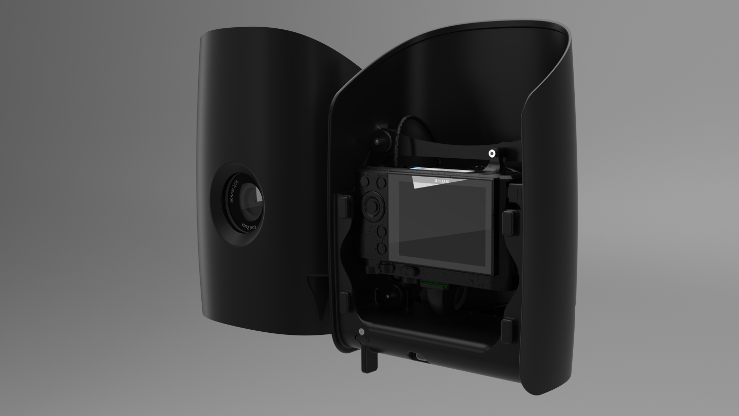
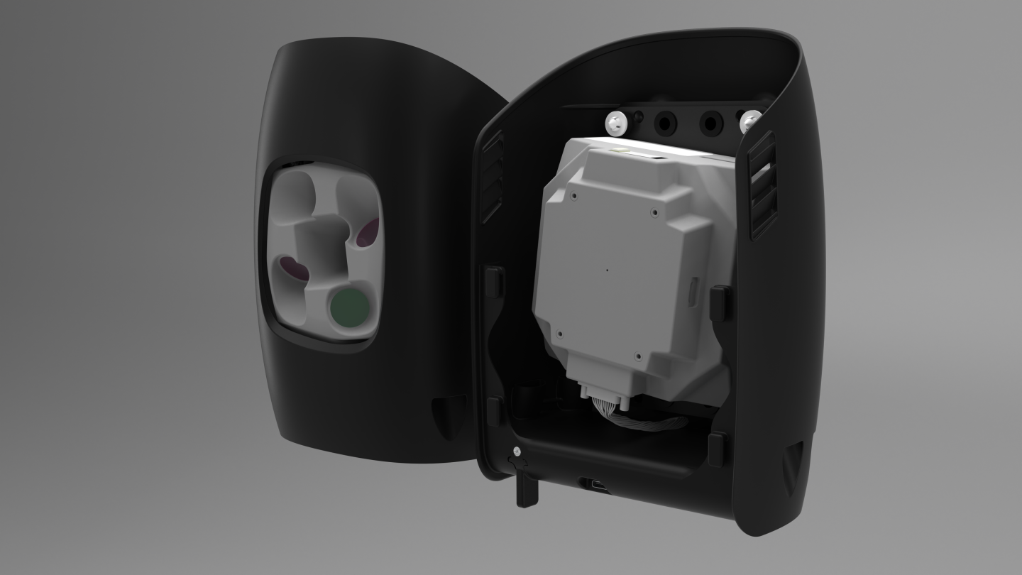
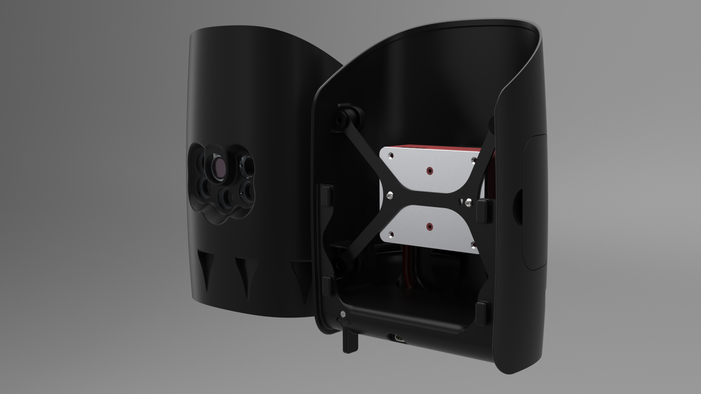
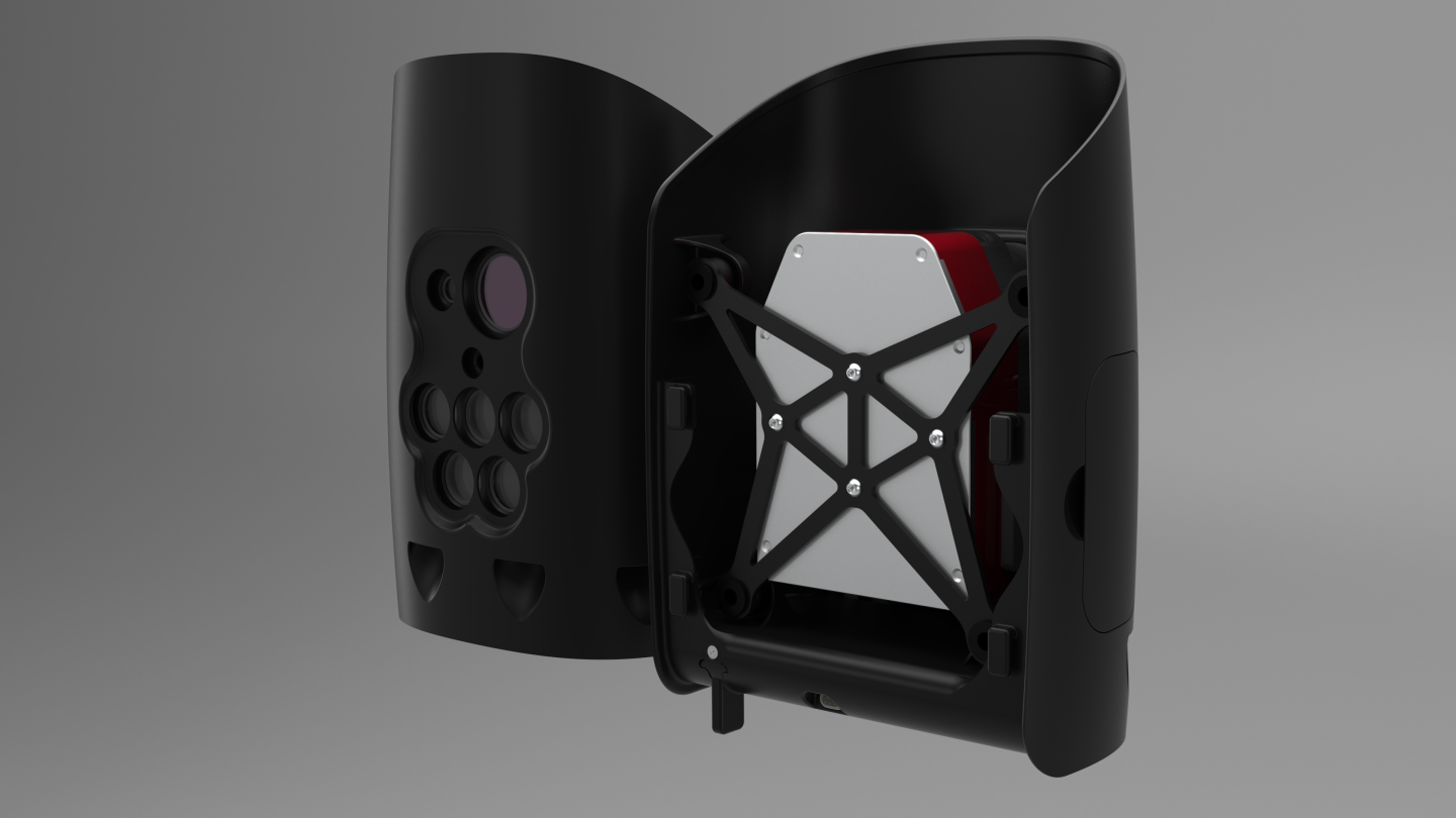
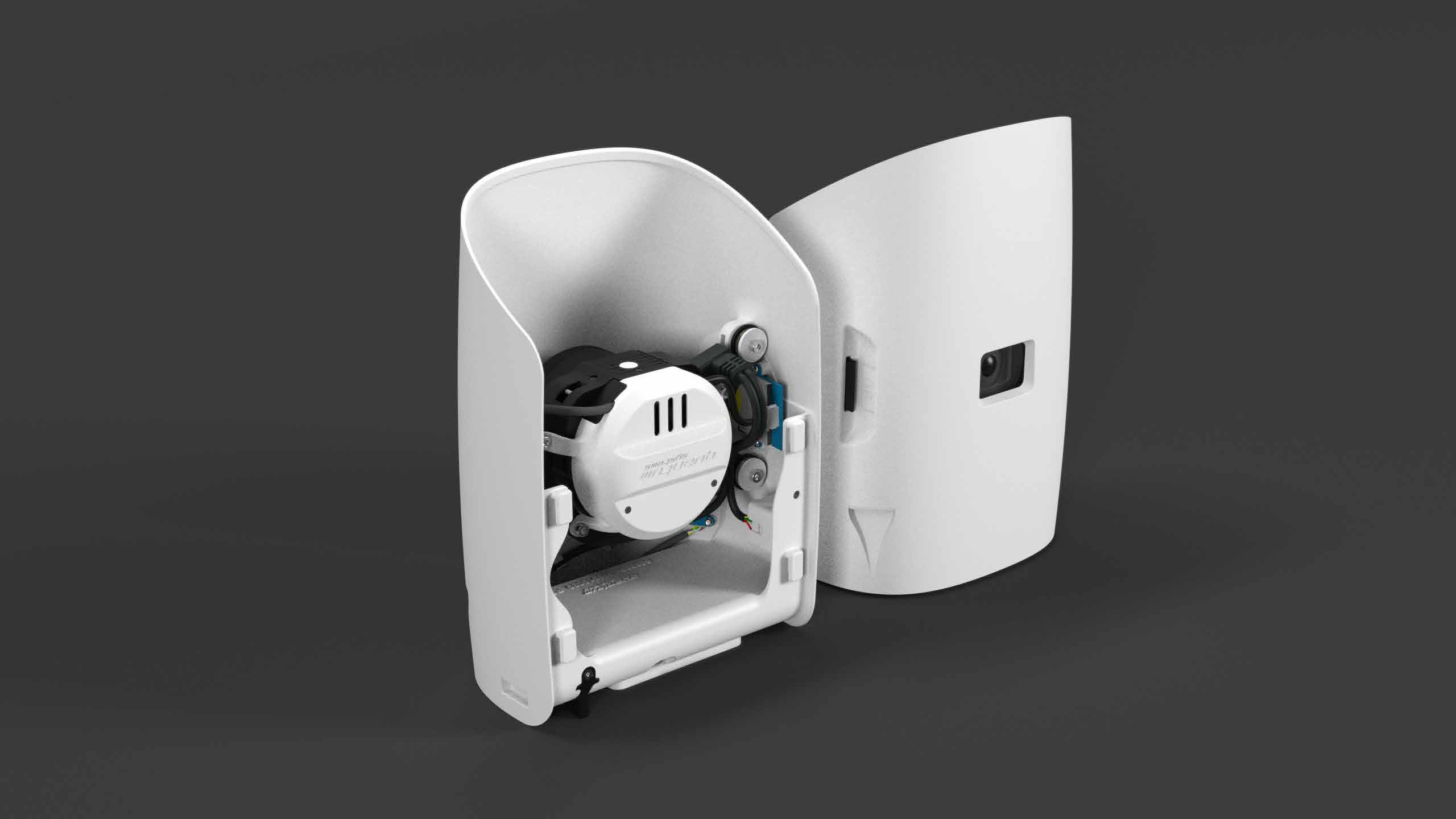
Cameras
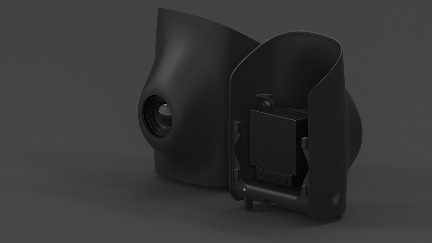
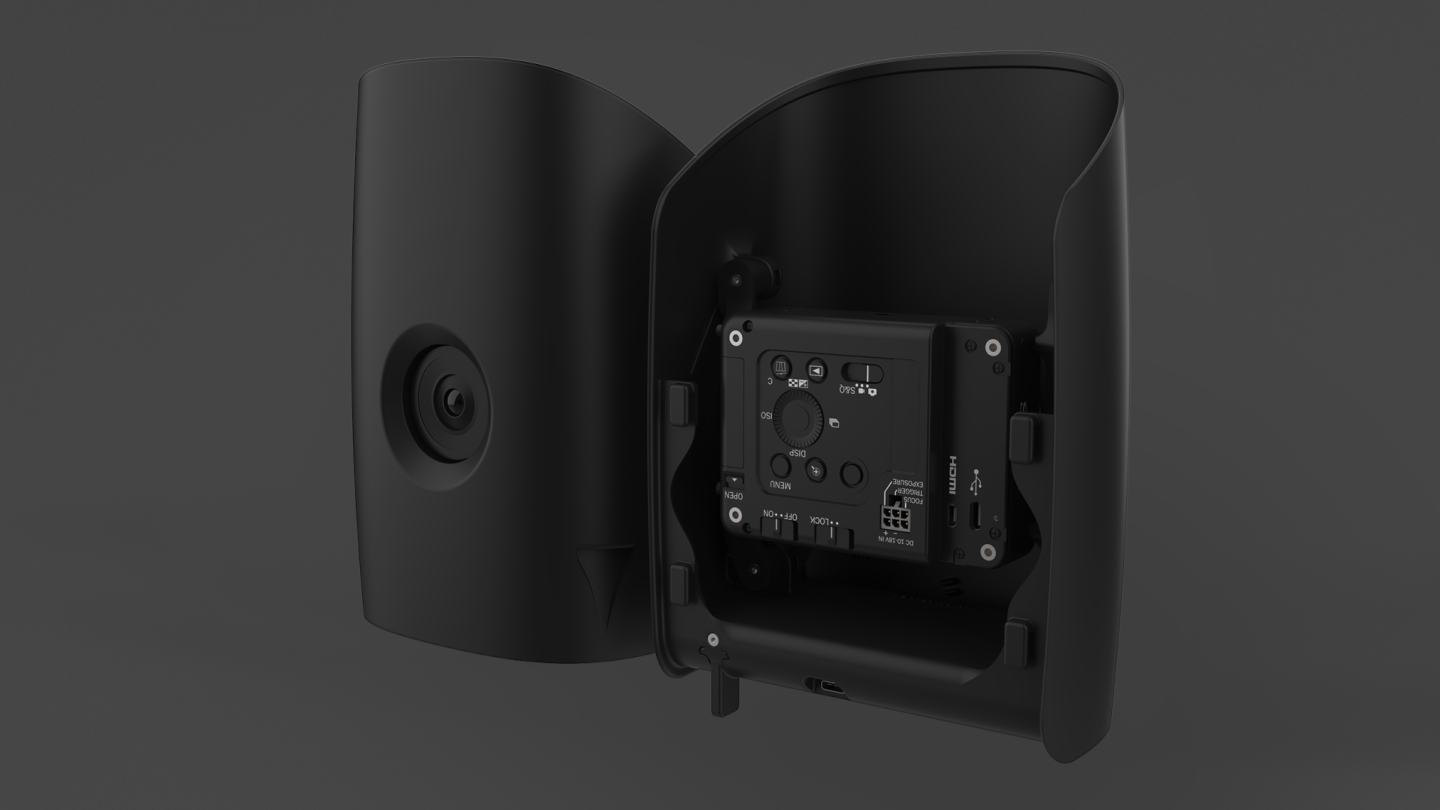
Trinity Pro is currently equipped with six different fully integrated cameras, including RGB, oblique, multispectral and LiDAR. They are easy to change by means of the quick-locking mechanism of the payload bay. The entire system architecture allows for easy camera integration.
Qube 640 – LiDAR Scanner
Phase One P5 – RGB Camera
Sony ILX-LR1 – RGB Camera
Qube 240 – LiDAR Scanner
Sony RX1 RII – RGB Camera
Oblique D2M – Five-Lens RGB Camera
MicaSense RedEdge-P – RGB and Multispectral Camera
Altum PT – RGB, Multispectral and Thermal Camera
Sony UMC-R10C – RGB CAMERA
Qube 240
- Wavelength – 905 nm
- Maximum altitude – 140 meters AGL
- Exposed radiate – 100 m AGL
- Accuracy: 1.8 – 2.5 cm*.
- Accuracy – <3 cm**
- Scanner field of view – 70
- Shots per second – 240,000
- Dot density @100 m – 50 -100 dots/m2
- Multi-Echo Technology – up to 3 echoes per shot
- Payload weight – 948.7 g
- Flight time – 60 minutes
Sony RX1 RII
- Sensor resolution – 42.4 MP (7952 × 5304 px)
- GSD – 1,29 cm @100m AGL
- Trigger interval – 1.4 seconds
- Sensor type Sensor format – CMOS
- Sensor size: full frame
- Objective – 35.9 mm × 24.0 mm
- Payload weight – f=35 mm, F2.0
- Storage – SD Card (internal slot)
Oblique D2M
- GSD – 1,50 cm @100m AGL
- Cameras – 1 x NADIR, 4 x oblique
- Sensor resolution – 26 MP (6252 x 4168 px)
- Total resolution – 130 MP
- Trigger interval – ≥ 0.8 seconds
- Sensor type – CMOS
- Sensor format – APS-C
- Sensor size – 23,5 x 15,6 mm
- Focal length – 25 mm NADIR, 35 mm (oblique)
- Payload weight – 833.7 g
- Flight time – 60 minutes
- Storage – Data storage (640 GB)
MicaSense RedEdge-P
- Sensor resolution Wavelength – 1456 x 1088 (1.6MP per MS band), 2464 x 2056 (5.1MP panchromatic band)
Azul (475 nm center, 32 nm bandwidth), Verde (560 nm center, 27 nm bandwidth), Rojo (668 nm center, 14 nm bandwidth), RedEdge (717 nm center, 12 nm bandwidth), infrarrojo cercano (842 nm center, 57 nm bandwidth). - RGB GSD color output – 5.1 MP (global shutter, aligned to all bands)* 7.7 cm per pixel (per MS band) at 120 m (393 ft) AGL 3.98 cm per pixel (panchromatic band) at 120 m (393 ft) AGL
- Triggering interval of interfaces – 0.8 sec.
- Field of view – 3 configurable GPIO / select between trigger input, PPS input, PPS output and frame start signals.
USB 2.0 port for WiFi. Series. Ethernet 10/100/1000. 50° HFOV x 38° VFOV (MS), 44° HFOV x 38° VFOV (PAN) - Storage – CFexpress Card
- Payload weight – 503.7 g
- RTF dimensions -8.9 x 7.0 x 6.7 cm (3.5in x 2.8in x 2.6in)
- External power supply – 7,0 V – 25,2 V
- Input power – 5.5/7.0/10 W (standby, average, peak)
*With appropriate post-processing
MicaSense Altum-PT
- Sensor resolution – 2064 x 1544 (3.2 MP per MS band), 4112 x 3008 (12 MP per PAN band) 320 × 256 thermal infrared.
- Band – Blue (475 nm center, 32 nm bandwidth), Green (560 nm center, 27 nm bandwidth), Red (668 nm)
at center, 14 nm bandwidth), Red edge (717 nm at center, 12 nm bandwidth), NIR 842 nm at center, 57 nm bandwidth).RGB Color – 12.4 MP (global shutter, aligned with all bands). - Thermal – FLIR LWIR thermal infrared 7.5-13.5um radiometrically calibrated
- Multispectral GSD – 5.28 cm per pixel at 120 m (per multispectral band)
- Thermal GSD – 33.5 cm per pixel at 120 m
- Panchromatic GSD – 2.49 cm per pixel at 120 m
- Trigger interval: 1.0 sec.
- Interfaces – 3 configurable GPIOs: select between trigger input, PPS input, PPS output and frame start signals. Virtual button. USB 2.0 port for WiFi. Series. Ethernet 10/100/1000. Field of view – 50° HFOV x 38° VFOV (multispectral) 46°
HFOV x 35° VFOV (panchromatic) 48° x 39° (thermal). Storage – CFexpress Card - RTF payload weight – 733.7 g
- Flying time – 60 min.
- Dimensions – 11.0 x 8.0 x 6.9 cm (4.3 in x 3.1 in x 2.7 in)
- External power supply – 7,0 V – 25,2 V
- Input power – 5.5/7.0/10 W (standby, average, peak)
Specifications
| Maximum take-off weight | 5,75 kg |
| Maximum payload weight | 1 kg |
| Width | 2.394 m |
| Dimensions of case L x W x H |
1002 x 830 x 270 mm
|
| Maximum flight time (1) | 90 min |
| Linear coverage | 100 km |
| Area Coverage (2) | 700 ha |
| Maximum takeoff altitude [sobre MSL] (3) | 4800 m |
| Maximum flight altitude | 5500 m |
| Optimal cruising speed | 17 m/s |
Wind tolerance
| Stationary flight phase (takeoff/landing) (4) | 11 m/s |
| Continuous (cruise) (5) | 14 m/s |
| Burst (cruise) (5) | 18 m/s |
| Income protection ratio | IP54 |
| Operating temperature range | -12 a +50 °C |
| transmitter frequency | 2,4 GHz |
| Transmitter output power | 100 – 1.000 mW |
| Command and control range | 5 – 7,5 km |
(1) Subject to export regulations. Limited to 59 min by default.
(2) Sony RX1 RII, at 120 m flight altitude and 1.5 cm GSD.
(3) Tolerance to the stationary wind reduced to 5 m/s.
(4) 8 m/s or 15.6 knots with Qube 240 or Oblique D2M.
(5) Subject to export regulations. Limited to 12.8 m/s or 25 knots by default
What is included in Trinity Pro?
A flight-ready Tactical Trinity includes a GNSS module for collecting raw GNSS data in flight, plus the following items:
| iBase GNSS reference base station | Portable base station to enable high-precision PPK processing |
| ADS-B USB receiver set | Integrates live air traffic information into QBase |
| Airborne data sensor | |
| QBase 3D ground control station software | Mission planning software, including QBase Longrange 2.4 GHz modem and cable |
| Manual control | Cable control for manual intervention in critical phases of flight or emergency situations |
| 3 battery packs and 1 charging unit | |
| Anemometer | |
| Lightweight carrying case |
