


")
")
")
")
")
PHANTOM 4 RTK SE
For users who need accurate data
Upgrade your next mapping mission with the Phantom 4 RTK SE, DJI’s most compact and accurate low altitude mapping solution.
DJI has rethought its drone technology from the ground up, revolutionising systems to achieve a new standard of accuracy, providing Phantom 4 RTK SE customers with centimetre-accurate data while requiring fewer ground control points.
Therefore, the Phantom 4 RTK SE is the perfect tool for users who need accurate data.

Fewer ground control points needed for accurate data collection
D-RTK2 mobile station, provides accurate results in areas with mobile coverage
Long battery life, providing up to 24 minutes of flight time
Integrated flight planning application
Operation resume function, which means that the flight will automatically resume after battery change
Supports RTK and PPK solutions
Phantom 4 RTK SE against Phantom 4 Pro V2
One of the biggest differences is that the Phantom 4 RTK SE was built with professionals in mind, thanks to its high-precision mapping capability. Previous models, such as the Phantom 4 Pro, were created for professional and amateur photographers.
At the camera level, the Phantom 4 RTK SE has improved mapping capabilities, thanks to a new lens distortion recording process. The new changes made the Phantom 4 RTK SE remote control more versatile and feature-rich. The remote control has a micro SD card slot and a built-in speaker, it can also be used to connect to the Internet via a 4G dongle.

APPLICATION OF
FLIGHT PLANNING
A new application called GSRTK offers control with two planning modes: data collection (photography) and landmark flights;
Traditional flight mode, with the possibility of taking photographs and videos.
Pilots can choose the drone’s flight path while adjusting other elements such as speed, altitude and camera parameters.
In addition, the model has other features such as high wind alerts, image exposure control and a new shutter.
D-RTK 2 Mobile Station
The Phantom 4 RTK SE can be complemented with the D-RTK 2 mobile station, which provides real-time differential data to the drone and helps collect the most accurate data.
TIMESYNC
The new TimeSync system is designed to continuously align the flight controller, camera and RTK module. In addition, it ensures that each photo uses the most accurate metadata and corrects the positioning data from the camera sensor.


Accurate imaging system
Capture the best image data with a 20-megapixel, 1-inch CMOS sensor. Each lens goes through a rigorous calibration process, with parameters stored in the metadata of each image, allowing the post-processing software to be uniquely adjusted for each operator.
ACCESSORIES
Stay on mission longer with commercial accessories

DRONE
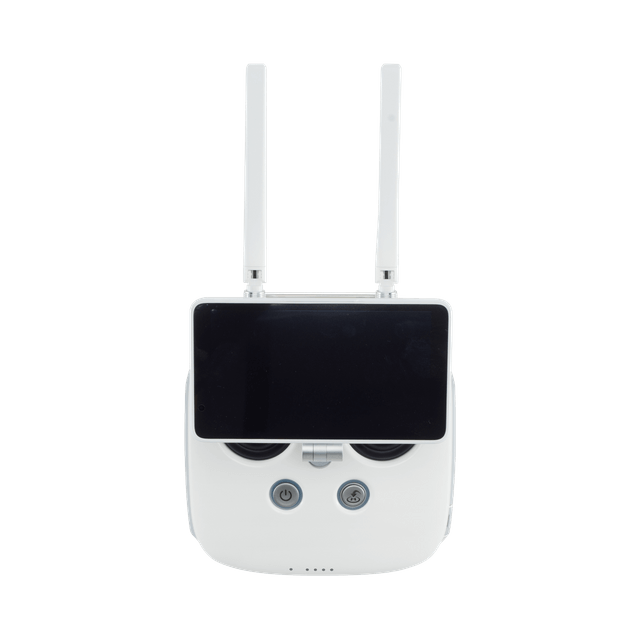
REMOTE CONTROL WITH SCREEN
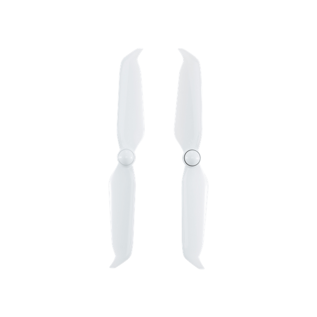
PROPELLER (PAIR)
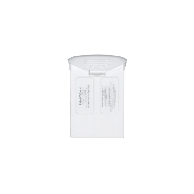
INTELLIGENT BATTERY FOR FLIGHT
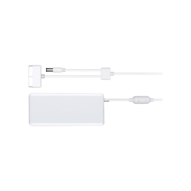
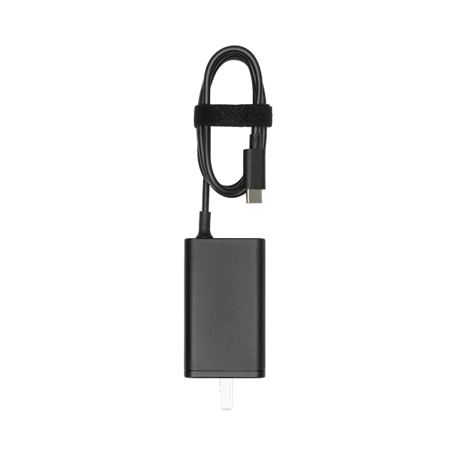
POWER ADAPTER
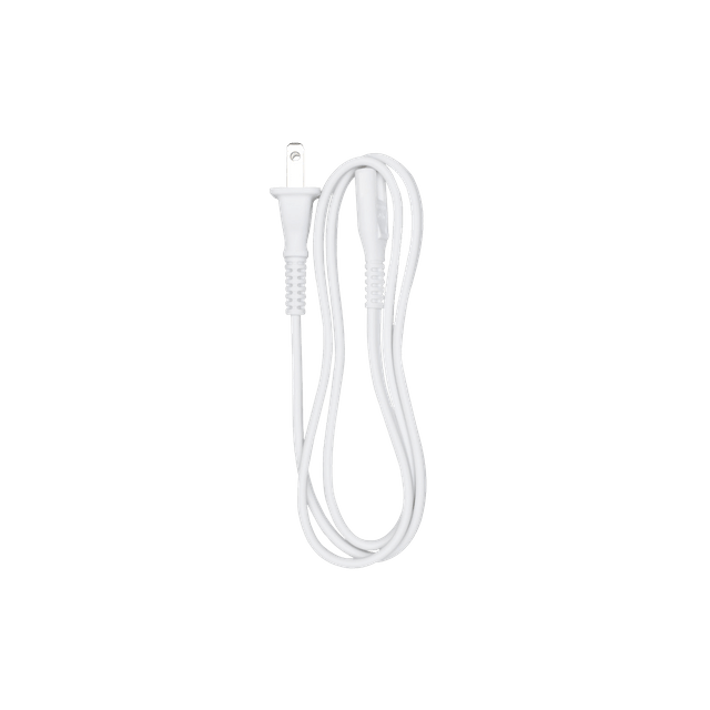
AC POWER CORD
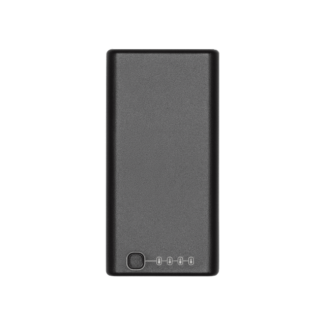
65W PORTABLE CHARGER
SMART BATTERY FOR REMOTE CONTROLLER (WB37)
FREQUENT QUESTIONS
Product Frequently Asked Questions
How does the Phantom 4 RTK SE differ from previous Phantom series products?
While previous models in the Phantom 4 series were aimed at professional and amateur photographers, the Phantom 4 RTK is aimed at business users performing high-precision mapping and similar data collection tasks. The Phantom 4 RTK SE has a similar shape and size. As well as an RTK positioning module, the new TimeSync system and a mapping application, among other things.
Which propellers does the Phantom 4 RTK SE use?
The Phantom 4 RTK SE uses the same 9455S quick release propellers as the Phantom 4 Pro.
Can I fly the Phantom 4 RTK SE in other countries or regions?
No, the Phantom 4 RTK SE has country and/or region specific versions. Users can check their version code on the product packaging or in the GS RTK application (go to Aircraft Information – Firmware).
Frequently Asked Questions about Camera
What is the difference between the Phantom 4 RTK SE camera and the Phantom 4 Advanced/Pro camera?
While the Phantom 4 RTK SE and Phantom 4 Pro/Advanced share the same one-inch, 20-megapixel CMOS sensor, the Phantom 4 RTK SE’s camera has undergone a process of measuring and recording lens distortion for mapping purposes. All Phantom 4 RTK SE cameras undergo a calibration process in which lens distortion is measured and recorded in parameters. The camera allows users to take images without distortion correction, along with the distortion correction parameters in an XMP file for post-processing.
Can the ND filters of the Phantom 4 Pro be used with the Phantom 4 RTK SE?
Yes, the ND filters from the Phantom 4 Pro can be used for the Phantom 4 RTK SE.
Can the Phantom 4 RTK SE’s digital camera signal processor correct distortions?
No, you can enable distortion correction in-camera, but the images will be less accurate than those that can be obtained by removing distortion in post-processing.
How is the Phantom 4 RTK SE camera calibrated?
All Phantom 4 RTK cameras go through a calibration process in which lens distortion is measured and recorded in XMP DewarpData parameters. When “distortion correction” is disabled, the original image will be saved with the distortions. When “distortion correction” is activated, distortion is removed using the factory settings, not the calibrated ones. Distortion correction is not performed pixel by pixel.
Frequently Asked Questions about Remote Control
What are the highlights of the Phantom 4 RTK SE standard remote control?
- Integrated 5.5 inch display, 1080p, up to 1000 cd/m² You can view the display in direct sunlight. The controller can operate at low temperatures.
- Hot swapping of batteries is possible.
- The pre-installed GS RTK application can execute missions in modes such as Photogrammetry or Trajectory.
- OcuSync video streaming
How can I switch between FCC and CE modes?
No se puede cambiar entre los modos FCC y CE.
Can I connect the Phantom 4 RTK SE to other Phantom series remote controls?
No.
Frequently Asked Questions about Video Transmission
What is the video transmission range of the Phantom 4 RTK SE?
The effective video transmission range depends on your working configuration (e.g. antenna position) and flight environment. In an open, unobstructed area, the maximum range is 7 km according to FCC standards and 5 km according to CE standards. (2.4 GHz).
What should I do if the application sends me the following notification: “the remote controller signal is weak, please adjust the antenna”?
This means that incorrect antenna placement will affect the video transmission and the quality of the real-time view. You can adjust the antennas so that the flat side of the antenna faces the Phantom 4 RTK SE.
Can I continue my automated mapping task if the Phantom 4 RTK SE loses the video signal during the task?
Yes, if the video signal is lost you can reconnect and resume the task.
Frequently Asked Questions about Batteries
Can I use the batteries from my Phantom 4 Pro with the Phantom 4 RTK SE and vice versa?
Yes, the Phantom 4 RTK SE and Phantom 4 Pro have compatible batteries, with the same capacity. This means that flight time will not be affected.
How long does it take to fully charge a Phantom 4 RTK SE battery?
It takes about 60 minutes to fully charge the Phantom 4 RTK SE battery.
How should I maintain and store the batteries?
Batteries should be stored in a dry, cool and well-ventilated place, away from possible fires, high temperatures or flammable materials. Do not place the battery in an environment that may cause the battery temperature to rise, such as in direct sunlight or inside a car exposed to the sun. For long-term storage, make sure that the charge level is above 50 %, but not fully charged. The battery should be charged and discharged every three months to keep it active if it is stored for a long time.
What does it mean when the battery icon turns yellow in the application?
This means that the battery is low on charge. Be careful when flying in this situation.
Can I use the Phantom 4 RTK SE batteries at low temperatures?
Battery capacity and, therefore, flight time will drop dramatically at low temperatures. (<-10 °C/14 °F). It is recommended that you warm the batteries to 20 °C/68 °F before take-off to lessen this effect. To ensure flight safety, the battery cannot be charged if the temperature is below 5 °C/41 °F or above 40 °C/ 104 °F.
Why do batteries start to heat up after being stored for a long time?
This phenomenon is normal. When batteries are stored for a long time with more than 65% charge remaining, an automatic discharge process will be initiated to reduce the battery to 65%. This will cause the battery to heat up.
Frequently Asked Questions about Positioning and Orientation
What options do I have for referencing the Phantom 4 RTK SE positioning data?
- Connect through OcuSync to your D-RTK 2 Mobile Station. (RTCM3.2)
- Remotely connect to a custom RTK network with a 4G accessory using an NTRIP account. (RTCM3.2)
- Connect remotely via Wi-Fi to a customized RTK network with an NTRIP account. Not available in Europe. (RTCM3.0/RTCM3.1/RTCM3.2)
What positioning accuracy can the Phantom 4 RTK SE achieve?
The Phantom 4 RTK can capture data with an accuracy of 1 cm + 1 ppm (horizontal) and 1.5 cm + 1 ppm (vertical).
What is TimeSync and how does it ensure accurate positioning of every image taken with the Phantom 4 RTK SE?
TimeSync continuously synchronizes the flight controller, camera and RTK module, and adjusts the positioning data to the CMOS center, saving the data in EXIF and XMP format.
What is the difference between PPK and RTK modes, how are they used?
RTK and PPK are two different kinematic technologies and reference data in different ways. Although PPK is generally slightly more accurate than RTK, both achieve centimeter-level accuracy. RTK is recommended for users who will be flying in environments with real-time connection via OcuSync or 4G and who prefer practicality and efficiency. For users who have enough time and do not mind operating offline, PPK is a better option.
What PPK file types does the Phantom 4 RTK SE support? What are these files for and how do I use them?
EVENTLOG.bin is a binary file containing the logs, time data and information about the exposure.
PPKRAW.bin is a file in RTCM3.2 MSM5 format containing satellite information and ephemeris data.
Rinex.obs is a file in RINEX format created after encoding.
Timestamps.MRK is a file in ASCII format containing exposure information and temporal data.
How do I find the XMP information in the photos taken with my Phantom 4 RTK SE?
Open the photo in text format and search for “XMP” to find this information in each photo.
When I take a photo with the Phantom 4 RTK SE, what is the reference point of the positioning information?
Thanks to the new TimeSync system, each photo stores the position of the CMOS center in the metadata.
Where can I find the offset value between the phase center of the antenna and the center of the CMOS sensor?
For each photo the offset level between the phase center of the RTK module antenna and the CMOS sensor is stored in the time stamp in the NED coordinate system, in a .MRK file in the “survey” folder.
What calculation method does the PPK cloud service use?
Kinematic post-processing can be performed with the PPK cloud service in two different ways: With the DJI Base Station and with a RINEX Base Station.
(1) DJI Base Station: Connect the DJI D-RTK 2 High Accuracy GNSS Mobile Station to the remote control with a USB cable to upload the PPK data to the base station. Once the server has the aircraft and D-RTK 2 information, it will automatically start the PPK calculations.
(2) RINEX base station: Converts satellite information received from third party base stations to the RINEX standard format. Then, import the PPK information to the remote control and upload it to the cloud for PPK calculations.
In which folder on the SD card should I save third party satellite data for kinematic post-processing calculations with a RINEX base station, where will the calculation results be saved?
You should save the third party satellite data in the folder \third_base, and place it in the root directory of the remote control’s SD card. The post-processing results will be saved in (root directory)\DCIMSURVEY(mission name)\result.csv.
¿Cómo puede conseguir el servicio PPK en nube de coordenadas de las estaciones base de terceros si estoy utilizando una estación base RINEX para realizar los cálculos PPK?
(1) If the RINEX file contains an “APPROX POSITION XYZ” field, which includes the approximate location of the base station in the ECEF coordinate system, the cloud PPK service will be able to compare it with the information collected in the field and convert it to geographic coordinates. These coordinates will be set by default as the phase center of the base station antenna.
(2) Users can manually enter the longitude and latitude information of the base station, as well as the distance between the lowest part of the base station and the antenna phase center (APC). With this information, the PPK cloud service will perform calculations based on the user’s manually entered antenna phase center.
(3) The cloud PPK service can also get the location of the antenna phase center through single point positioning (SPP) with RINEX information. These coordinates will be used for PPK calculations. *
*Available only in Europe at this time.
Where is the PPK cloud service available?
The service is available in all countries except the USA, Canada, Hong Kong and Macau.
Where are the coordinate files saved when I use the D-RTK 2 mobile station as an RTK scanner?
You can find it at Download.
How does the RTK scanner perform the measurements?
There are two ways:
(1) Instantaneous measurement
(2) Average of 10 values measured over a period of 2 seconds.
Does the D-RTK 2 Mobile Station need to have the RTK set to “FIX” to be used as a scanner?
(1) If you want to perform instantaneous measurements, it must be set to “FIX”.
(2) For average measurement, it is recommended that it be set to “FIX”.
How can I update the firmware of the D-RTK 2 Mobile Station?
At this time you can only update it via the Phantom 4 RTK remote control (not the Remote Control SDK).
What is the “RTK positioning accuracy maintenance” mode?
When the RTK positioning accuracy hold mode is enabled, and if signals from the RTK base station are lost, the positioning accuracy will slowly decrease from the absolute accuracy of 1 cm + 1 ppm down to approximately 20 cm. The RTK Flag value in the image XMP data will be 16, and the RTK status of the remote control will remain FIX.
Frequently asked questions about the software
¿Cómo puedo actualizar el firmware del Phantom 4 RTK SE?
Updating the Phantom 4 RTK SE firmware is similar to updating the Phantom 4 Pro firmware. You can update the remote control and aircraft firmware separately with DJI Assistant 2.
You can also update the drone and the remote control at the same time with the GS RTK application. First you have to connect the remote control to the aircraft with the OTG and USB cables. Then follow the instructions in the GS RTK application on the remote control.
In which situations are the lateral infrared sensors activated?
At this time the infrared sensors are not active, fly with caution.
What software can I use to plan flights and control my Phantom 4 RTK SE?
You can use the GS RTK application to plan and control flights. For mapping missions you can use the specialized PC software DJI Terra. If you have purchased a Remote Control SDK, you can also use DJI GS Pro, DJI Pilot and other third-party applications that have been developed using DJI’s Mobile SDK.
Which mapping platform is used as the source of mapping data for the Phantom 4 RTK SE application?
Mapbox supplies map data to the GS RTK application.
What are the benchmark limitations of the Phantom 4 RTK SE?
In the GS RTK application the maximum number of reference points is 199. In DJI Terra the reference points can be up to 2 km away, and only a maximum of 99 points can be set. The total distance of a Trajectory mission cannot exceed 40 km, and in Photogrammetry mode the maximum distance is 100 km.
Can I set reference points by typing longitude and latitude values in the Trajectory mode?
No.
When importing KML area files into software programs, what is the maximum number of perimeter points I can set?
The maximum number of perimeter points supported by the GS RTK application is 199. In Terra’s case, it is 99.
In which missions can I import KML files?
In the following missions: 2D Photogrammetry (Photogrammetry 2D), 3D Photogrammetry (Dual Grid) (Photogrammetry 3D wpcodeself),[Double Grid] 3D Photogrammetry (Multiple Orientation) (Photogrammetry 3D wpcodeself[Multi-oriented]), Area Segmentation (Block Segmentation) and Constant Height (Terrain Awareness).
In Terrain Awareness mode, is there any way to disable the display of the terrain redrawing map?
Yes. Click on the — icon in the upper right corner during this mode, then click on the — icon in the sidebar. You will reach the general settings, where you can disable this display.
When is it advisable to use Block Segmentation?
Area segmentation divides large areas of territory into several flight paths to improve mission efficiency. It offers the best results when flying over relatively flat areas without major elevation changes.
How do I use area segmentation to plan flight missions?
(1) Select area segmentation (2) Set the area to be mapped: you can do this manually or import kml files
(3) Adjusts grid dimensions and direction (4) Adjusts camera settings and overlap ratio.
In area segmentation, are flights planned separately for each section, or are they planned as a whole?
Flight routes are planned jointly. It is not possible to adjust the overlap ratio, altitude, direction or other parameters for each section separately.
How do I control several aircraft at the same time during area segmentation missions?
When planning is complete, link each Phantom 4 RTK SE to each corresponding flight mission. You can then start one of the missions separately, or all of them at once.
How many Phantom 4 RTK SE can I control at a time with area segmentation?
A maximum of 5.
If I work with several aircraft at the same time, can I collide with each other?
No. Thanks to obstacle detection technology, when two or more Phantom 4 RTKs approach each other, they will decelerate or hover. They will only continue their mission when the area has been cleared.
Can I run a mission with Phantom 4 RTK SE using altitude above sea level?
Yes, but only in Trajectory.
How do I use the altitude above sea level to fly with the Phantom 4 RTK SE?
(1) Access the RTK configuration and check that the RTK status is FIX.
(2) Select Trajectory and add reference points with RTK enabled. The system will automatically record the altitude with respect to sea level of each reference point.
(3) Select Absolute Altitude in the altitude pop-up window when performing the operation.
Can I use the altitude above sea level in a mission if I do not have RTK enabled or if its status is not FIX?
No. In such cases you can only use the default altitude.
How much do I have to adjust the Relative Height?
When there is a difference between the altitude of the take-off point and that of the area to be mapped, you can adjust the Relative Height to ensure sufficient overlap ratios in the measurement. See the illustration below for more information:
If the drone takes off from a 50 m building (H1 in the illustration), is going to map area A and the altitude at which it takes aerial images is expected to be 100 m, you can set the mission altitude to 100 m, and the relative altitude to 50 m. Similarly, if the drone takes off from H2 to map area B, which is a 40 m high hill, and the expected altitude for aerial image capture is 60 m, you can set the mission altitude to 60 m and the relative altitude to -40 m. You can adjust the relative altitude (Relative Height) in 2D Photogrammetry, 3D Photogrammetry (Dual Grid) (Photogrammetry 3D) and 3D Photogrammetry (Dual Grid) missions [Double Grid]), 3D Photogrammetry (Multi-Orientation) (Photogrammetry 3D [Multi-oriented]), Linear Flight Mission and Block Segmentation.
In what situations can variable altitude flight path missions be used?
Variable altitude flight paths are useful for taking modeling photographs in terrain with large differences in altitude, such as power transmission lines, roads, and rivers with ascending and descending topography.
Are there altitude and angle restrictions between reference points when planning a variable altitude flight path?
There are no altitude restrictions between two reference points. The actual flight altitude is determined by the altitude limit. There are no angle restrictions.
Does a variable altitude flight path mission support imported KML files? What are the requirements for KML files?
Yes. Click on the “KML” icon in the function menu to select the file. The KML file type must be linear and the format of the field for absolute altitude in the KML file must be “absolute”.
What is “mission altitude” in a variable altitude flight path mission?
It is the distance between the flight plane and the plane between the points A, B and C.
It is the distance between the flight plane and the plane between the points A, B and C.
Yes, a flight path can be executed in reverse sequence. After a flight path has been generated from the recorded landmarks, click the reverse sequence button at the bottom of the interface to reverse the landmark flight sequence.
In what situations can slope flight paths be used?
They are useful for situations involving model elements such as slopes and building facades. Slope flight path planning generates flight paths automatically for sloping surfaces or facades, and correctly collects photogrammetric data.
What is the function of the flight path plan view when executing a slope flight path mission?
During a slope flight path mission, the application interface will display an image transmission window, a map view window and a plan view window. The plan view window is located in the lower right corner of the interface. During a mission, it can display the flight path from a vertical perspective with respect to the aircraft and thus help determine the area to be mapped and position the aircraft.
¿Qué son la “distancia de la misión” y la “altitud de la misión” en una misión de ruta de vuelo en pendiente?
The “mission distance” and “mission altitude” are used to adjust the distance between the flight plane and the plane between points A, B and C. If the slope is steep or completely vertical, you can select the perpendicularity mode with respect to the target plane and adjust the distance between the flight plane and the plane between points A, B and C by setting the “mission distance”. If the slope is relatively flat, you can use the perpendicularity mode with respect to the horizontal plane and adjust the distance between the flight plane and the plane between points A, B and C by setting the “mission altitude”.
How do I ensure flight safety when planning a slope flight path?
When planning the reference points for a flight path over the sloping plane between points A, B and C, pay attention to the area to be mapped taking into account the predetermined expanded distance from point C, and make sure that there are no flight safety risks within the predetermined expanded area.
Frequently Asked Questions on Cartography and Mapping
What formats does the Phantom 4 RTK SE support for differential data?C
The Phantom 4 RTK SE currently supports RTCM 3.0, RTCM 3.1, MSM4, MSM5, MSM6 and MSM7 data under RTCM3.2.
Are the coordinates collected by the Phantom 4 RTK SE relative or absolute?
The coordinates collected by the Phantom 4 RTK SE are absolute coordinates in WGS84.
How can I calculate the appropriate flight altitude based on a certain ground pixel size?
You can use the equation H = 36.5 × GSD to estimate the appropriate flight altitude. Note that the ground pixel size (GSD) in this equation is measured in centimeters, while the flight altitude (H in the equation) is measured in meters. For example, the GSD is 2.74 cm at 100 m altitude.
Is any real altitude information stored in the photos taken with the Phantom 4 RTK? If so, how is it stored?
The Phantom 4 RTK SE collects altitude relative to sea level and altitude relative to your take-off point. The altitude with respect to sea level can be used for mapping, while the relative altitude can be found in the XMP file.
How do I capture a video still image with the Phantom 4 RTK SE?
Oblique images can be captured by flying in photogrammetric mode in the GS RTK application. In photogrammetric mode, you can adjust the stabilizer angle from -90° to -45° in Camera Settings according to your flight plan. Only one stabilization angle can be set at a time, so if you want to capture the same location from several angles you will have to plan the same mission with different camera angles.
Can I create a 3D model or point cloud using third-party software with photos taken with the Phantom 4 RTK SE? If so, how accurate is the model created?
Yes, you can use third-party software to process Phantom 4 RTK SE image data and create models. However, accuracy will vary depending on the photogrammetric algorithm used. Consult the software vendor for more information regarding the accuracy to expect.
How accurate are the models generated by the Phantom 4 RTK SE when no ground control point (GCP) is established, and are the accuracy requirements met for aerial triangulation at 1:500 scale?
Orthoimages created from images captured by the Phantom 4 RTK SE with dedicated reconstruction software have shown an absolute accuracy of approximately 5 cm, when the accuracy required for aerial triangulation at a scale of 1:500 is less than 30 cm. Esto significa que la precisión del Phantom 4 RTK cumple los requisitos para la cartografía aérea a escala 1:500.
Is the Phantom 4 RTK SE compatible with third-party base stations?
No, you cannot connect third-party base stations to the Phantom 4 RTK SE or remote control via a radio station. However, you can get the data from an RTK server on a Wi-Fi or 4G network with the NTRIP protocol. Users can store satellite data in the aircraft to perform kinematic post-processing (PPK) to complete their tasks.
If inaccuracies in elevation information occur when collecting orthoimages with the Phantom 4 RTK SE, what could be the cause?
The causes may be, among others:
(1) Ground control points (GCP) are set in a different coordinate system or with a vertical datum that does not correspond to the position of the Phantom 4 RTK. Make sure that the coordinate systems match.
(2) The RTK status of the Phantom 4 RTK SEno is FIX. Asegúrese de que el estado de RTK es FIX antes de iniciar la recogida de datos.
(3) The internal camera parameters used during post-processing are not accurate.
If the internal camera parameters used by the post-processing modelling software are inaccurate, resulting in inaccurate altitude, how can altitude accuracy be improved when collecting orthophoto data using a Phantom 4 RTK SE?
The “Altitude Optimization” is already configured by default in the parameter settings for the planning modes “2D Photogrammetry” and “Area Segmentation”. After enabling this feature, the Phantom 4 RTK will return to the center of the mapped area after completing the flight path, and gather images of the slope features to improve altitude accuracy. This function is only applicable to the planning modes “2D Photogrammetry” and “Area Segmentation”.
What is included in Phantom 4 RTK SE?
1 x Drone Phantom 4 RTK SE
1 x remote control with display
4 x pairs of propellers
2 x high capacity smart batteries
1 x battery charger
1 x power cable
1 x gimbal protection
1 x micro SD card
1 x quick start guide
1 x USB cable
1 x Carrying case (Styrofoam type)
* D-RTK 2 Base can be purchased together or separately.
SPECS
Access to technical specifications
AIRCRAFT
| Take-off weight | 1391 g |
| Diagonal Distance | 350 mm |
| Max Service Ceiling Above Sea Level | 6000 m (19685 feet) |
| Max. speed in ascent | 6 m/s (automatic flight); 5 m/s (manual control) |
| Max. speed in descent | 3 m/s |
| Max. speed |
50 km/h (31 mph) (P mode) 58 km/h (36 mph) (A MODE) |
| Max. flight time | 30 minutes aprox. |
| Operating temperature range | 0 a 40 °C (32 a 104 °F) |
| Operating Frequency |
2.400 GHz a 2.483 GHz (Europe, Japan, Korea) 5.725 GHz a 5.850 GHz (United States, China) |
| Transmission Power (EIRP) |
2.4 GHz CE (Europe) / MIC (Japan) / KCC (Korea): < 20 dBm
5.8 GHz SRRC (China) / FCC (United States) / (Taiwan, China): < 26 dBm |
| Accuracy range of hovering flight |
RTK activated and working properly: Vertical: ±0.1 m; Horizontal: ±0.1 m
RTK disabled Vertical: ±0.1 m (with visual positioning); ±0.5 m (con posicionamiento GNSS) Horizontal: ±0.3 m (with visual positioning); ±1.5 m (with GNSS positioning) |
| Image position offset | To compensate for the difference between the camera center and the phase center of the D-RTK antenna, an adjustment (36, 0 and 192 mm) has been made to the image coordinates in Exif format. The positive x, y, and z axes of the aircraft body point to the front, right and downward of the aircraft respectively. |
MAPPING FUNCTIONS
| Mapping accuracy** |
The accuracy of the mapping meets the requirements of Class III of the ASPRS accuracy standards for digital orthophotography. ** Actual accuracy will depend on lighting conditions and ground patterns, aircraft altitude, mapping software used, and other factors external to the recording. |
| Ground pixel size (GSD) |
(H/36.5) cm/pixel, Where H is the altitude of the aircraft relative to the recorded scene (expressed in meters). |
| Data collection efficiency | Max. operating area of approx. 1 km² for a single flight (at an altitude of 182 m, for example, with a GSD of approx. 5 cm/pixel, meeting the requirements of Class III of the ASPRS accuracy standards for digital orthophotography. |
VISION SYSTEM
| Speed range | ≤ 50 km/h (31 mph) a 2 m (6.6 pies) of the floor with adequate illumination |
| Altitude range | 0 – 30 m (0 – 33 feets) |
| Operating range | 0 – 30 m (0 – 33 feets) |
| Obstacle detection range | 0.7 -30 m (2 – 98 pies) |
| Field of view |
Front/Rear: 60º (horizontal), ±27º (vertical) Lower: 70º (front and rear), 50º (side) |
| Detection frequency |
Front/Rear: 10 Hz; Lower: 20 Hz |
| Operating Environment | Well-patterned surfaces and adequate lighting (> 15 lux) |
CAMERA
| Sensor | 1″ CMOS Effective pixels: 20 MP |
| Lens | FOV 84° 8.8 mm / 24 mm (35 mm equivalent format) f/2.8 – f/11, focus at 1 m – ∞ |
| ISO Range |
Vídeo: 100 – 3200 (auto) 100 – 6400 (manual)
Photograph: 100 – 3200 (auto) 100 – 12800 (manual) |
| Mechanical shutter speed | 8 – 1/2000 s |
| Electronic shutter speed | 8 – 1/8000 s |
| Max Image Size |
4864×3648 (4:3); 5472×3648 (3:2) |
| Video modes | H.264, 4K: 3840×2160 30p |
| Photo Format | JPEG |
| Video formats | MOV |
| Supported file systems |
FAT32 (≤ 32 GB ); exFAT (> 32 GB) |
| Supported SD cards | MicroSD, Max. capacity: 128 GB. Write speed ≥15MB/s, class 10 or UHS-1 required. |
| Operating temperature range | 0 a 40 ºC (32 a 104 ºF) |
INTELLIGENT FLIGHT BATTERY (PH4-5870 mAh-15.2 V)
| Capacity | 5870 mAh |
| Voltage | 15.2 V |
| Battery Type | LiPo 4S |
| Energy | 89.2 Wh |
| Net weight | 468 g |
| Load temperature range | -10° to 40 ºC (14° to 104 ℉) |
| Max. load power | 160 W |
SDK REMOTE CONTROL
| Operating Frequency |
2.400 GHz a 2.483 GHz (Europe, Japan, Korea) 5.725 GHz a 5.850 GHz (Other countries/regions) |
| PIRE |
2.4 GHz CE / MIC / KCC: < 20 dBm
5.8 GHz SRRC / FCC / NCC: < 26 dBm |
| Max. Transmission Distance |
FCC /NCC: 7 km (4.3 miles); SRRC / CE / MIC / KCC: 5 km (3.1 miles) (No obstacles or interference) |
| Built-in Battery | 6000 mAh, 2S LiPo |
| Charging time | 1.2 A @7.4 V |
| Support for mobile device | Tablets and smartphones |
| Operating temperature | De 0 a 40° C (de 32 a 104° F) |
GNSS
| High-sensitivity, single-frequency GNSS module |
GPS + BeiDou + Galileo* (Asia); GPS + GLONASS + Galileo* (other regions) |
| High-precision multi-system, multi-frequency GNSS RTK |
Frequency used: GPS: L1/L2; GLONASS: L1/L2; BeiDou: B1/B2; Galileo*: E1/E5a
Time of first positioning: < 50 s
Vertical 1.5 cm + 1 ppm (root mean square); Horizontal 1 cm + 1 ppm (root mean square) 1 ppm indicates an increase in error of 1 mm for every 1 km of aircraft movement. |
Gimbal
| Stabilisation | 3-axis (tilt, roll, pan) |
| Tilt | -90° a +30° |
| Max. angular speed controllable | 90°/s |
| Rango de vibración angular | ±0.02° |
INFRARED
| Obstacle detection range | 0.2 – 7 m (0.6 – 23 feets) |
| Field of view |
70º (horizontal) ±10º (vertical) |
| Detection frequency | 10 Hz |
| Operating Environment | Surface with diffuse reflection and reflectivity > 8% (such as walls, trees, people, etc.) |
Remote Controller
| Operating Frequency |
2.400 – 2.483 GHz (Europe, Japan, South Korea) 5.725 – 5.850 GHz (China, United States) |
| Transmission Power (EIRP) |
2.4 GHz CE / MIC / KCC: < 20 dBm
5.8 GHz SRRC / FCC: < 26 dBm |
| Max. Transmission Distance |
FCC: 7 km (4.3 miles); SRRC / CE / MIC / KCC: 5 km (3.1 miles) (Unobstructed, interference free) |
| Consumo eléctrico | 16 W (average value) |
| Presentation paper |
5.5-inch display, 1920×1080, 1000 cd/m², Android system Memory: 4 GB RAM + 16 GB ROM |
| Operating temperature range | 0 a 40 ºC (32 a 104 ºF) |
POWER ADAPTER (PH4C160)
| Voltage | 17.4 V |
| Power rating | 160 W |
