Drone surveying allows the configuration of the land to be surveyed to be represented on a map or plan in order to gain a deeper and more detailed knowledge before starting to carry out the corresponding works on the land.
Drones are used in many fields, and surveying was not going to be left behind. This has meant a complete and revolutionary advance in many of its fields. In short, the application of this technology in the topographic sector has achieved a significant improvement in productivity for each and every project.
Topographic surveys provide a guarantee of efficiency and quality in the works to be carried out on the ground. Therefore, if you want to carry it out, we tell you about the advantages of topography with drones.
What is a topographic survey and what is it for?
A topographic survey is the technical description or graphic representation of a terrain. Its objective is to examine the surface of the desired space and to detail both its physical, geographical and geological characteristics, as well as the alterations that exist in it. Nowadays, topographic surveys are used for a wide range of activities, the main ones being:
- Measure plots and land. The drone is capable of measuring the entire surface of the desired land. It is commonly used in the process of buying and selling in order to fix the surface area, carry out a cadastral update or start a project.
- To prepare expert reports. The use of drones to collect data for the preparation of expert reports is a key factor. It allows you to determine a firm proof of geometry, as well as the determined location of a property.
- Territorial limitation. Drones are capable of limiting land and adjusting to the corresponding measurements. It can be of great help in the initial phases of works in which the land needs to be staked out, in neighbourhood conflicts in which it is necessary to mark plot boundaries and in inheritances, among others.
How to do topography with drones step by step
Carrying out a topographic survey with drones is not an easy task, so we explain step by step everything you need to do to carry it out properly and correctly.
- Locating the land. First of all, it will be necessary to locate the land and fix its exact measurements, i.e. to limit it territorially. This localisation can be done by finding the location of the terrain, working it and placing it on the area with a polygon.
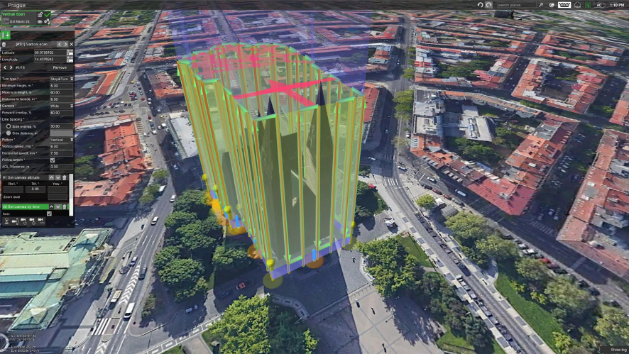
- Configuring the software. It is very important to configure the software to be used depending on the topographic survey and the drone to be used.
- Analyse the weather. Analysing the weather is very important to take into account subsequent weather forecasts. Drones are capable of helping us with this, although it is important to go to the area where the flight is going to take place and see the weather conditions that exist. This will be done to take into account, for example, the type of wind that is going to be present, as without taking this into account, photogrammetry will not work.
- Plan the checkpoints and position. Once we have determined that the weather conditions are favourable, we can both plan the position and take into account the control points located with targets on the ground. In this way, the drones will be able to locate them and record geo-referenced topographical references.
- Analyse the extracted data. Once the process has been completed, it is important to download all extracted data in order to analyse them and make the corresponding decisions.
What are the advantages and benefits of using drones in surveying?
As mentioned above, there are an increasing number of sectors to which drones are being applied, and surveying is one of them. Below, we will mention some of the main advantages that the use of this technology provides to this activity.
- Reduce working time. Collecting data with a drone is much faster than with more traditional cutter surveying systems. With this type of technology, the working time is significantly reduced. To show the advantage, a team of 2 people can take between 20 and 30 days to collect data for 1000 hectares, whereas the drone can do it in a time frame of 1 or 2 days.
- Costs are reduced. Logically, reducing working time has a direct impact on reducing costs. On the other hand, being able to fly over the terrain means that, in many cases, traffic does not have to be stopped in any way.
- Longer range. In addition, drones can reach areas that are much more difficult or unreachable due to terrain conditions, as they can fly over the area easily and safely.
- Reduced risk to operators. Thanks to the use of drones in topographic surveys, operators have the advantage of assuming fewer risks in carrying out their work.
- Higher precision and efficiency. Thanks to the use of drones in topographic surveys, it is possible to enjoy greater precision in the data and information obtained. While with conventional total stations and GPS it is only possible to obtain discrete data, with the drone it is possible to capture all the information of the terrain.
Drones for surveying. The best surveying drones at HPDRONES
At HPDRONES we have a wide variety of drones, which are able to help you carry out a perfect topographic survey. If you want to know some of the main models that will help you the most when carrying out this activity, below, we show and explain some of them.
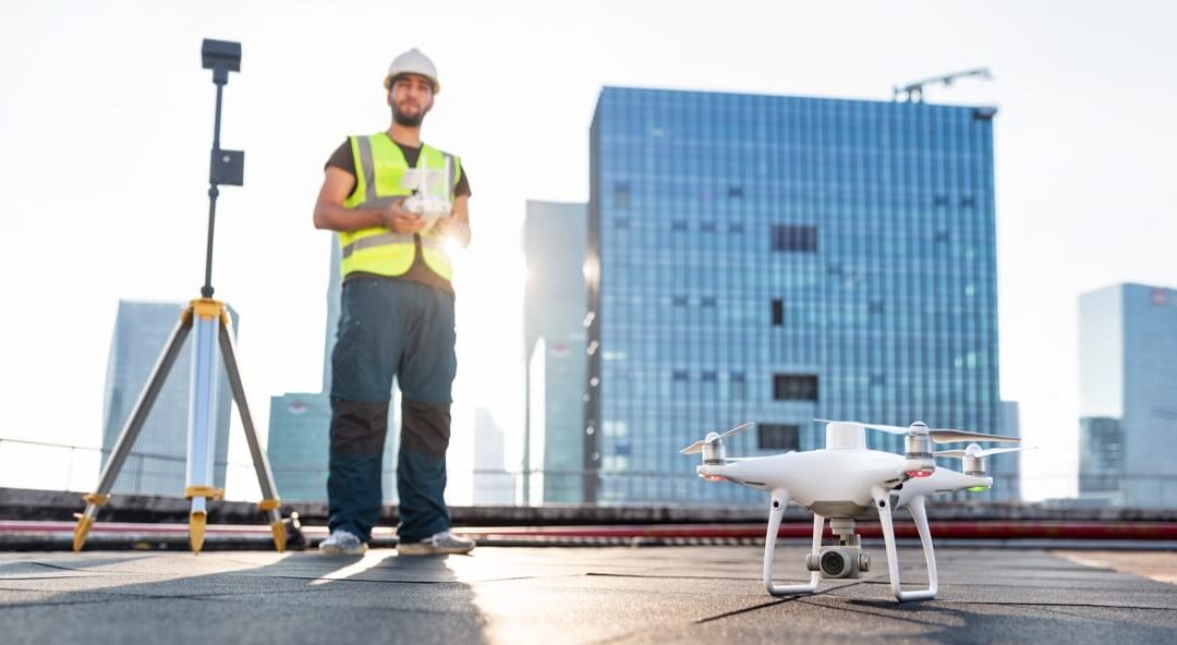
- Phantom 4RTK. Ensuring the health of your business. The Phantom 4 RTK is a high precision drone, it has potential benefits in the research industry with network organisations using the Ocusync 2.0 transmission system to achieve interference-free and unobstructed flights when operating in areas of high interference.
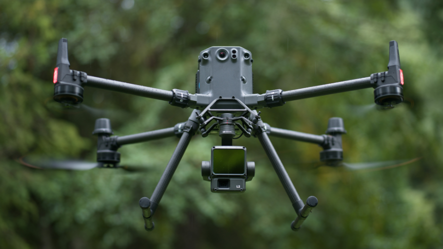
- Matrice 300 RTK. A new standard in the business drone industry. The Matrice 300 RTK is DJI’s newest commercial drone platform. It is inspired by the latest avionics systems. It offers high autonomy, with a flight time of up to 55 minutes; advanced AI and a UAV status management system, among others. The M300 RTK redefines what you can expect from a business drone with a leading combination of intelligent features, high performance and reliability.
- The M2EA is perfect for firefighting, search and rescue, law enforcement, energy inspection and environmental protection. It has high quality visual, thermal, zoom and RTK features.
Based on the above, it is possible to understand that drones represent a breakthrough, both for surveying and for many other fields. Moreover, it will be necessary to take into account that this technology and its application will continue to develop in the coming years. It is important to mention that although their advantages are great, it is still necessary to have skilled and trained surveyors in the profession.

