YellowScan Navigator.
From depth to height: handling bathymetric LiDAR with just one button.
Main features:
Indoor technology – YellowScan laser scanner
IMU Solution – SBG Quanta Micro
Integration:
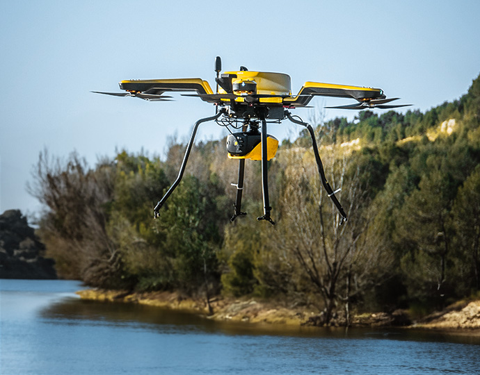
Multirotor | Helicopter Drone
Specifications:
Altitude AGL: Up to 100 m (330 ft)
System precision 2cm 0.8″
Battery weight excl. 1.8kg 4lbs
LASER SCANNER – A YellowScan Development
This solution features a laser scanner developed in-house by our R&D team over the past few years with testing beginning in 2023, refining the system for optimal performance. This evolution highlights our commitment to innovation and quality, especially in the development of advanced laser scanners. – YellowScan
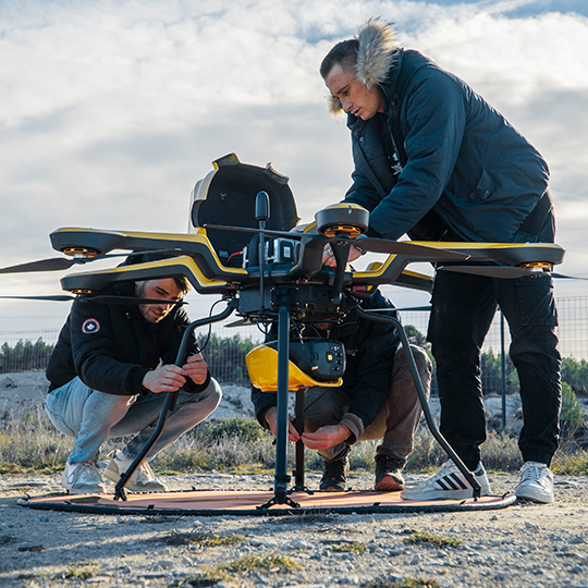
Key features
- Exposed AGL – Hasta 100 m (330 pies)
- System accuracy – 3 cm (1.2″)
- System accuracy – 3cm (1.2″)
- Battery weight excl. – 3,7kg (8,2lb)
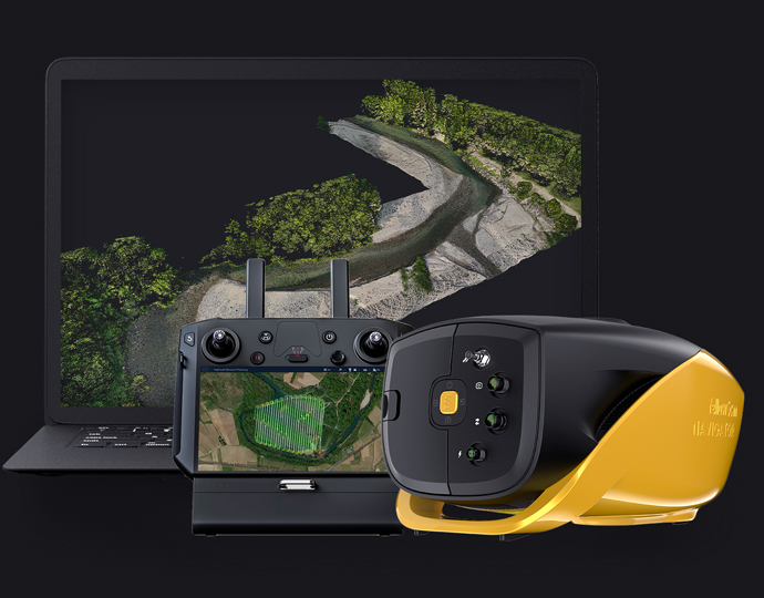
This system can be used in a multirotor UAV or helicopter. When it comes to drones, the GREMSY “quick release” accessory allows for easy mounting on a wide range of drones.
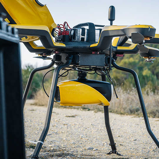
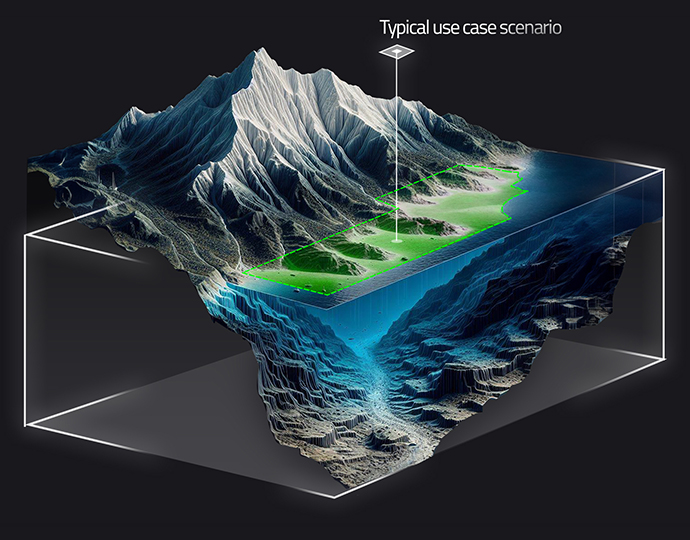
Simultaneous inspection of land and water
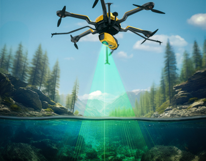
The YellowScan Bathymetric system is designed for shallow water bathymetric measurements and is rapidly deployed on a UAV. This full waveform LiDAR system ensures continuity between underwater points and the surrounding terrain.
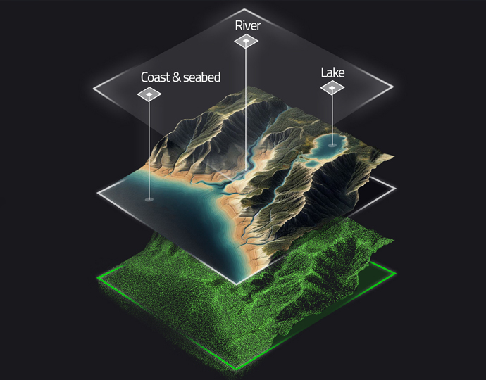
Diverse aquatic environments
Intended for aerial use with drones, the system covers various aquatic areas, such as coasts, rivers, lakes, estuaries, ponds and gravel pits. Navigator is easy to use and adapts to a wide range of applications, from hydrographic surveys to underwater resource management.
44° FOV for high accuracy
Our bathymetric system, with a 44-degree field of view, prioritizes accuracy over a wider angle. This decision is based on the fact that 44° is the maximum angle for a green laser to work effectively underwater. Beyond this angle, the depth of laser penetration into the water is significantly affected, limiting the overall performance of the system.
High autonomy to maximize efficiency
Optimize your bathymetric survey operations with our LiDAR system, which offers a 45-minute runtime on a single battery charge for extended underwater data collection in a variety of marine environments.
SPECS
Specifications
| laser scanner | YellowScan Development |
| GNSS inertial solution | SBG Quanta Micro |
| Precision | 3 cm |
| Accuracy | 3 cm |
| Typical flight speed | 5 m/s |
| Typical flight altitude | 80 m |
| Maximum flight altitude | 100 m |
| Dot density | 20 pts/sqm @ 80 m AGL 5 m/s |
| Laser range | Up to 120 m |
| Laser wavelength | 532 nm |
| Scanner field-of-view | 44º |
| Mín. Depth | 0.30 m |
| Max. Depth | 2 Secchi |
| Max. data generated | Up to 200 000 points / sec |
| Echoes per shot | Up to 10 / Full waveform |
| Shots per second | Up to 20 000 |
| Scanning frequency | Up to 50 Hz (selectable) |
| RGB camera | Integrated 2 MP global shutter |
| Weight | 3.7 kg (8.15 lbs) batt. excl. |
| Size |
L 350 x W 160 x H 190 mm |
| Autonomy | 45 min. typ |
| Power consumption |
120 W |
| Operating temperature | 0° to +40 °C |
| Laser class | Class 3B – Avoid direct exposure to light beam |


