SOUTH GALAXY 3
Behind every significant change in human society there is always the birth of an important technology. At the dawn of a new era, South is leading an era of high-precision positioning.
Features
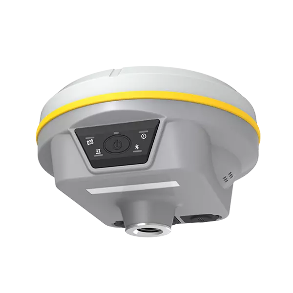
Color LED indicators
Longer battery life
Super radio and Farlink protocol
IMU for slope survey
SoC Technology
VERY LIGHT
Using multi-layer structure and high integration design, the Galaxy G3 receiver is very small, with dimensions 130mm X 80mm. Built with magnesium alloy materials, the weight is only 790g including internal battery, very light and convenient to carry.
Excellent performance
The excellent performance of the Galaxy G3 allows you to understand high-tech in the surveying and mapping industry.
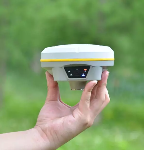
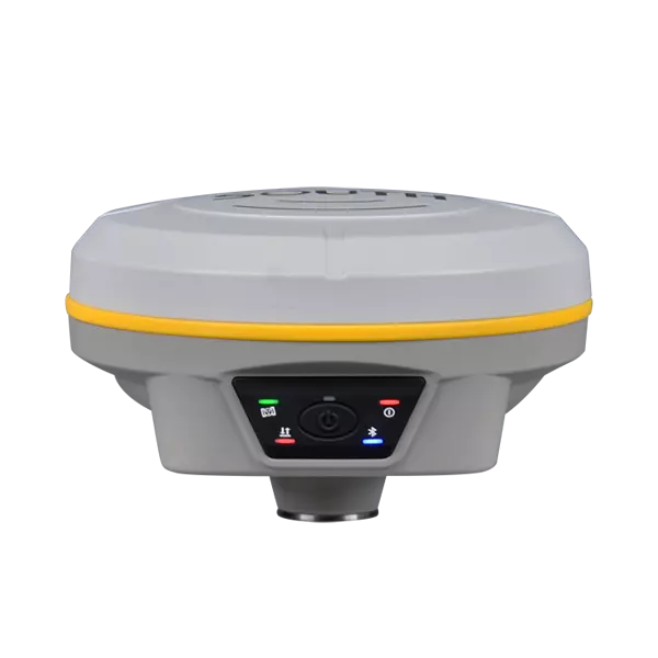
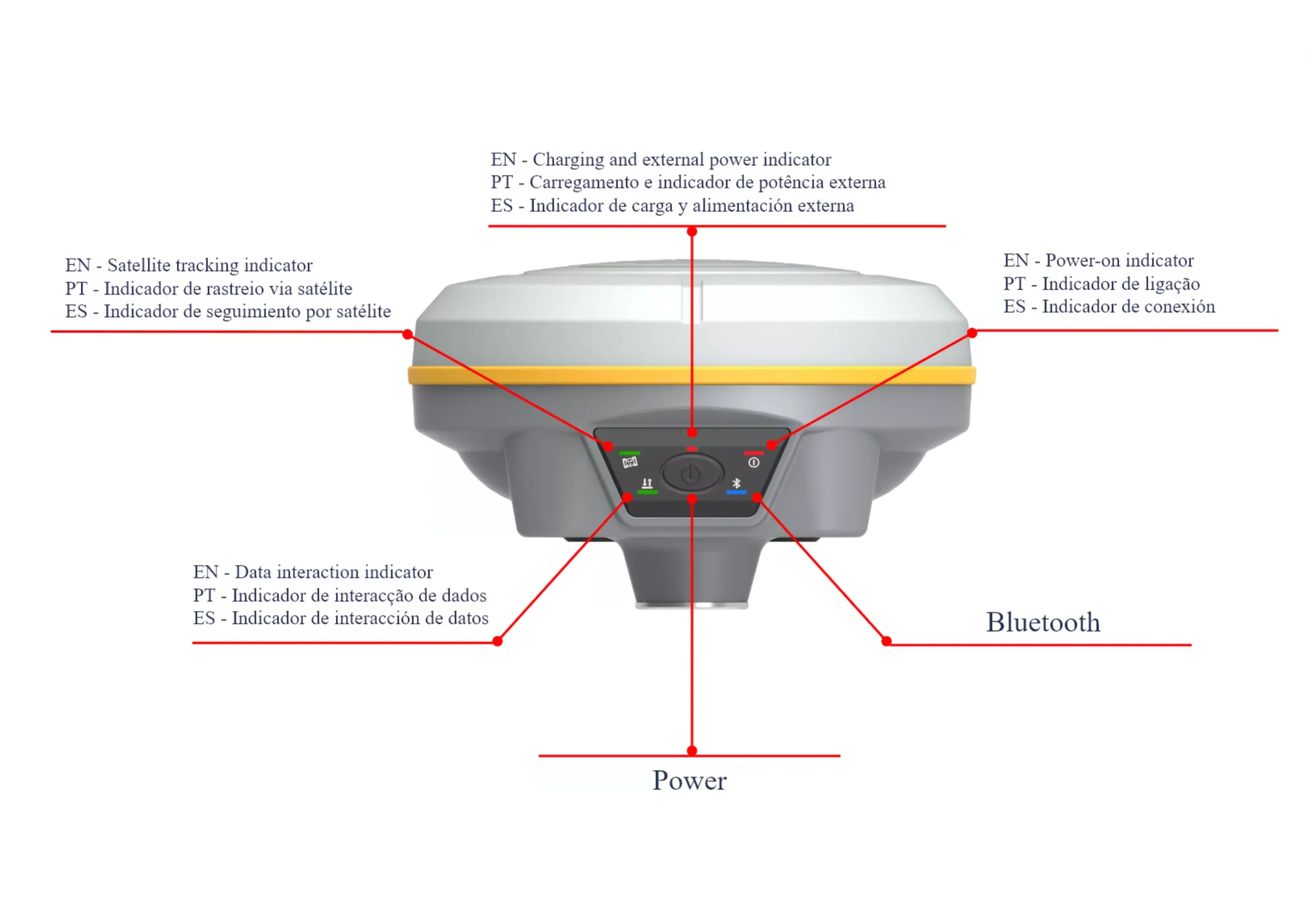
Independent indicators with different colors make the receiver’s working status and information clearer and more intuitive, and the function module can be clearly known even in bright light.
POWERFUL GNSS UNIT
G3’s GNSS card is integrated with an advanced SoC, a chip that features high integration and low power consumption, effectively suppresses interfering signals, and obtains higher quality observation data from satellite constellations
The GNSS board fits perfectly on the power board and is not removable.
High management and control capacity
The G3 is integrated with the ROS system, which comes with the intelligent implementation of multi-mode hardware components, strong computing power and intelligent scheduling mechanism, together with the ultra-thin memory management mechanism, make the receiver’s fluency and operating speed understandably improved.
RELIABLE WORKMANSHIP
It adopts the new “RTK engine algorithm” that optimizes data robustness, avoids the false point during survey, and ensures the reliability and stability of the coordinate result in complex environments.
Based on the signal tracking capability of the L-band, the Galaxy G3 can capture the precise orbit information and precise satellite clock error carried by the BeiDou-3 GEO satellite’s B2b signal, which can provide users with single-point positioning services at the centimeter level in real time through an accurate algorithm. The positioning is no longer restricted by the terrestrial environment, such as mountain, desert and island. The fixed solution is generally available as long as the GNSS constellations are visible.
SUPER PRODUCTIVITY
Excellent performance and reliable algorithm technology help surveyors increase productivity.
Equipped with a super UHF module developed by SOUTH – “Beaver”, comes with 2W transmission power, the Galaxy G3 really achieves the goal of long distance work using a new radio-Farlink communication protocol, which increases signal sensitivity and transmission efficiency.
The frequency of each channel under the “Farlink” protocol is different from the commonly used ones, which effectively prevent interference from other radio signals.
SPECIFICATIONS
| GNSS Features | Channels | 1598 |
| GPS | L1, L1C, L2C, L2P, L5 | |
| GLONASS | L1C/A,L1P,L2C/A,L2P,L3* | |
| BDS |
BDS-2: B1I, B2I, B3I BDS-3: B1I, B3I, B1C, B2a, B2b* |
|
| GALILEOS | E1, E5A, E5B, E6C, AltBOC* | |
| SBAS(WAAS/MSAS/EGNOS/GAGAN) | L1* | |
| IRNSS | L5* | |
| QZSS | L1, L2C, L5* | |
| L Band MSS | BDS-PPP | |
| Positioning output rate | 1Hz~20Hz | |
| Startup Time | < 10s | |
| Startup Reliability | > 99,99% | |
| Positioning Accuracy | GNSS differential positioning code |
Horizontal: 0,25 m + 1 ppm RMS Vertical: 0,50 m + 1 ppm RMS |
| Static (long observations) |
Horizontal: 2,5 mm + 1 ppm RMS Vertical: 3 mm + 0,4 ppm RMS |
|
| Static |
Horizontal: 2,5 mm + 0,5 ppm RMS Vertical: 3,5 mm + 0,5 ppm RMS |
|
| fast static |
Horizontal: 2,5 mm + 0,5 ppm RMS Vertical: 5 mm + 0,5 ppm RMS |
|
| PPK |
Horizontal: 3 mm + 1 ppm RMS Vertical: 5 mm + 1 ppm RMS |
|
| RTK(UHF) |
Horizontal: 8 mm + 1 ppm RMS Vertical: 15 mm + 1 ppm RMS |
|
| RTK(NTRIP) |
Horizontal: 8 mm + 0,5 ppm RMS Vertical: 15 mm + 0,5 ppm RMS |
|
| RTK initialization time | 2~8s | |
| SBAS Positioning | Typically < 5m 3DRMS | |
| L-BAND |
Horizontal: 5-10cm (5-30min) Vertical: 10-30cm (5-30min) |
|
| IMU | Tilt less than 10 mm + 0.7 mm/° for 30° | |
| IMU tilt angle | 0° ~ 60° | |
| Hardware Performance | Dimension | 130mm(W) ×130mm(L) × 80mm(H) |
| Weight | 790g (battery included) | |
| Material | Aluminum magnesium alloy shell | |
| Operating Temperature | -45℃ ~ +75℃ | |
| Storage Temperature | -55℃ ~ +85℃ | |
| Humidity | 100% non-condensing | |
| Waterproof/dustproof | IP68 standard, protected from prolonged immersion to a depth of 1m IP68 standard, fully protected against blowing dust | |
| Shock/Vibration |
Withstands 2-meter pole drop onto a concrete floor naturally MIL-STD 810G |
|
| Power Source | 6-28V DC, overvoltage protection | |
| Battery | Built-in rechargeable 7.2V 6800 mAh Li-ion battery | |
| Battery life | 3 PM (Bluetooth Rover Mode) | |
| Communications | I/O Port |
External 5-pin LEMO power port + RS232 type C (charging, OTG to USB disk, data transfer with PC or phone, Ethernet) 1 UHF antenna TNC interface |
| Internal UHF | 2W radio, receive and transmit, radio router and radio repeater | |
| Frequency Range | 410 – 470MHz | |
| Communication Protocol | Farlink, Trimtalk450s, SOUTH, HUACE, Hi-target, Satel | |
| Communication Range | Usually 8km with Farlink protocol | |
| NFC Communication | Automatic close-range pairing (less than 10 cm) between the receiver and the controller (controller requires another NFC wireless communication module) | |
| Bluetooth | Bluetooth 3.0/4.1 standard, Bluetooth 2.1 + EDR | |
| WI-FI | Modem | standard 802.11 b/g |
| Wi-fi access point | AP mode, the receiver broadcasts its access point from the web user interface accessing with any mobile terminal | |
| wi-fi data connection | Client mode, the receiver can transmit and receive correction data streams via WiFi data link | |
| Data storage/transmission | Store |
4 GB SSD Automatic cycling storage (the first data files will be automatically removed as long as the memory is not sufficient) Supports external USB storage |
| Data Transmission |
USB data transmission plug and play mode Supports FTP/HTTP data download |
|
| Data Format |
Static data formats: STH, Rinex2.01, Rinex3.02, etc. Differential format: RTCM 2.3, RTCM 3.0, RTCM 3.1, RTCM 3.2 GPS output data format: NMEA 0183, coordinate plane PJK, SOUTH Binary code Network model support: VRS , FKP, MAC, fully supports NTRIP protocol |
|
| Sensors | Electronic Bubble | The controller software can display electronic bubble, checking the carbon pole leveling status in real time |
| IMU | Integrated IMU module, calibration-free and immune to magnetic interference | |
| Thermometer | Built-in thermometer sensor, adopting intelligent temperature control technology, monitoring and adjusting the temperature of the receiver | |
| User Interaction | Operating System | Linux |
| Buttons | One Button | |
| Indicators | 5 LED indicators (Satellite, Charging, Power, Datalink, Bluetooth) | |
| web interaction | With access to the internal web interface management via Wi-Fi or USB connection, users can monitor the status of the receiver and change settings freely | |
| Voice Guidance | Provides voice guidance of status and operation. Supports: Chinese/English/Korean/Spanish/Portuguese/Russian/Turkish | |
| Secondary Development | Provides secondary development kit and opens OpenSIC observation data format and interaction interface definition | |
| Cloud Service | The powerful cloud platform provides online services such as remote management, firmware update, online registration, etc. |


