Micasense RedEdge-P dual
Two sensors. 10 bands.
For a better comparison of the data with the satellites. High-resolution RGB and multispectral composite drone sensor for plant classification, weed identification, environmental research and conservation, and vegetation analysis of water bodies. The dual solution includes the RedEdge-P and the new RedEdge-P blue cameras.
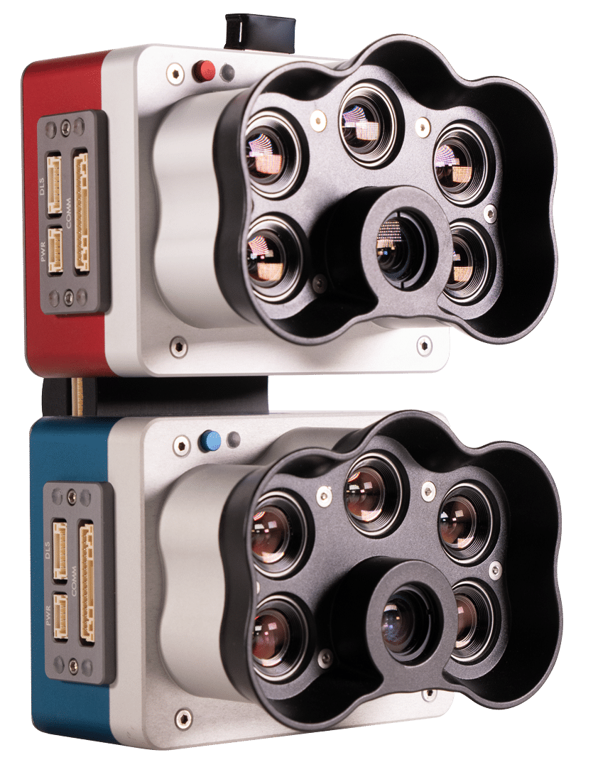
10 multispectral bands of 1.6 MP each.
Pan-sharpening technology.
Dual radiometric calibration with light sensor and calibration reflectance panel for reliable data in varying light conditions.
Global shutter on all 10 lenses for blur-free image capture.
Fast capture speed: 3 raw DNG images per second.
Synchronized capture of all 10 bands, automatic triggering and geotagging of images for efficient flight times and easy post-processing.
Features
- Ten multispectral bands
The dual-band RedEdge-P covers the Landsat 8 and Sentinel-2 satellite bands with improved spatial resolution.
- Panchromatic band for higher resolution
Dual RedEdge-P provides a GSD of 2 cm per pixel / 0.8 inches per pixel when flying at 60 m / 200 ft. Sharper images make it possible to detect small problems earlier and make reliable decisions.
- Coastal blue
The unique RedEdge-P dual coastal blue band is specially designed for aquatic vegetation analysis and weed identification in shallow water environments.
- Narrow bands
Narrow spectral bands are key to detecting subtle variations in plant condition and allow for more accurate data. The dual RedEdge-P is a narrow band sensor that captures the most relevant segments of the spectral curve.
BENEFITS
- Obtain images comparable to Landsat and Sentinel satellite data with improved resolution.
- Monitor shallow water environments with the coastal blue band.
- Conduct detailed analyses on chlorophyll efficiency and identify weeds.
- Perform reliable time series analysis even under varying light conditions.
- Perform machine learning and AI applications, such as early stage crop counting.
- Generate knowledge invisible to the naked eye with various results and indices, such as RGB, NDVI, NDRE, OSAVI, NIT, CIR, DSM.
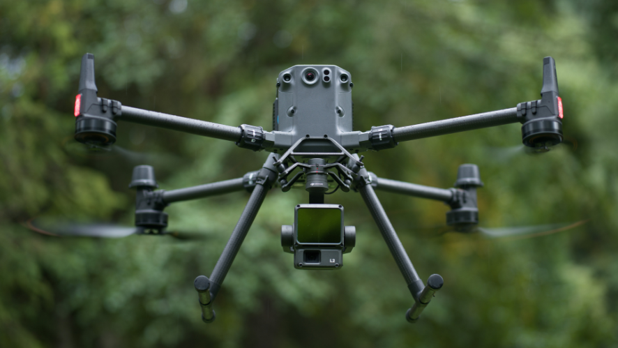
- Work with the equipment you already have: compatible with DJI Matrice 300 and a wide range of post-processing and flight planning software.
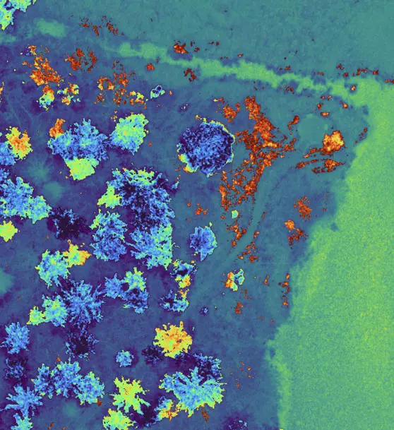
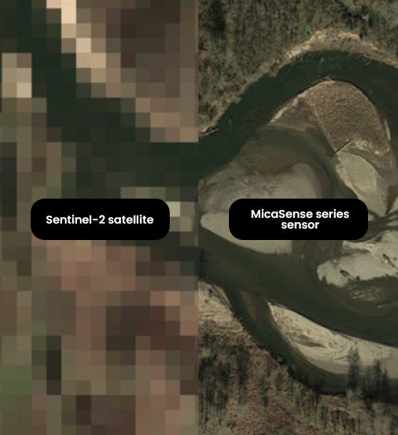
Correlate drone and satellite data
RedEdge-P’s dual bands cover the Landsat 8 and Sentinel-2 satellite bands (~10 m / 32 ft per pixel) with an improved spatial resolution of 2 cm / 0.8 in. Many indices already created by satellites can be used.
Performance of time series analysis
The RedEdge-P dual multispectral kit includes a calibrated reflectance panel (CRP) and a downward light sensor (DLS). These radiometric calibration tools take into account different weather and light conditions, providing data that allow reliable time series analysis and comparison of results over time.
AI applications
These radiometric calibration tools take into account different weather and light conditions, providing data that allow reliable time series analysis and comparison of results over time.
APPLICATIONS
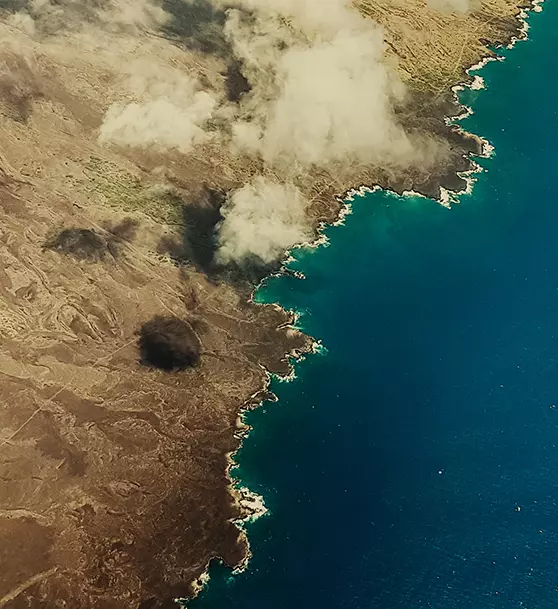
Analysis of the vegetation of water bodies
Water studies to examine chlorophyll efficiency, vegetation analysis and identification of floating, submerged and emergent algae or plants.
Environmental monitoring
Coastal and nearshore mapping for water resource management, tidal zones, wetlands and glacier monitoring.
Water management
Control of public water supply and management of water resources.
Monitoring, protection and restoration of habitats
Erosion and biodiversity survey, study of reefs in shallow waters, inaccessible to ships and sensitive to human interaction.
Identification of plant species and weeds
Vegetation health management and species identification, including the ability to differentiate and count plants, trees, invasive species and weeds.
RedEdge-P dual Kits
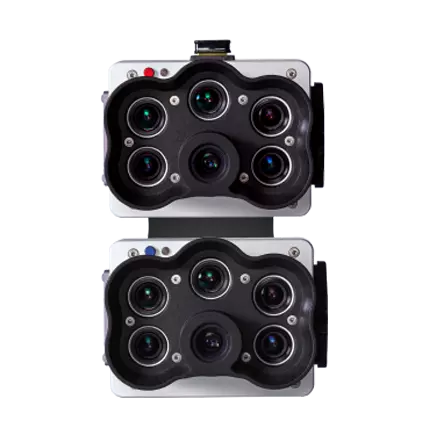
KIT MULTIESPECTRAL
| RedEdge-P |
| RedEdge-P blue |
| DLS light sensor |
| CRP calibrated reflectance panel |
| USB Wi-Fi cable |
| Objective cap |
| Integration cables |
| Mounting material |
| CFexpress card |
| CFexpress card reader |
| Rigid storage for transport |
| Initiation Guide |
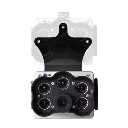
KIT UPGRADE MULTIESPECTRAL*
*Option for customers who already have a RedEdge-P.
| RedEdge-P blue |
| USB Wi-Fi cable |
| Objective cap |
| Integration cables |
| Mounting material |
| CFexpress card |
| CFexpress card reader |
| Rigid carrying case |
| Initiation Guide |
SPECIFICATIONS
| Weight | 745 g / 26,2 oz (two sensors, mounting accessories, DLS and cable) |
| Dimensions | 13,2 cm x 8,8 cm x 9,67 cm / 5,1 pol x 3,1 pol x 3,5 pol |
| Fuente de alimentación externa | 7.0 V – 25.2 V |
| Power input | 11/14,0/20 W (standby, medium, peak) |
| Sensor Resolution |
1456 x 1088 (1,6 MP per multispectral band) 2464 x 2056 (5.1 MP panchromatic band) |
| Spectral bands | Blue 475(32), Green 560(27), Red 668(14), Red Limit 717(12), NIR 842(57) |
| RGB output | 15.1* MP (global shutter, aligned with all tracks) *with proper post-processing |
| Capture rate | Up to 3 captures per second raw DNG – capture speeds vary depending on the recording speed of the USB storage device |
| Multispectral GSD | 7,7 cm/3 pulg. per pixel at 120 m/~400 ft AGL |
| Panchro e Pansharpened GSD | 3,98 cm/1,5 pulg. per pixel at 120 m/~400 ft AGL |
| Panchro e Pansharpened GSD | 2,49 cm por píxel a 120 m |
| Interfaces |
Three configurable GPIOs: select between trigger input, PPS input, PPS output and end-of-frame signals. Virtual host button. USB 2.0 port for WiFi. Series. Ethernet 10/100/1000. |
| Field of view |
50° HFOV x 38° VFOV (multiespectral) 44° HFOV x 38° VFOV (panchromatic) |
| Storage | CFexpress card |

