Q.Fly Explore
SWIR camera with Quantum Dots for DJI drones.
Q.Fly Explore
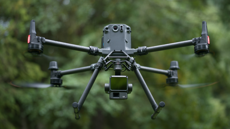
Quantum Solutions, presentó Q.Fly Explore™, una cámara SWIR basada en tecnología Quantum Dot desarrollada específicamente para UAV. Ofrece integración plug-and-play con los drones DJI Matrice 300, Matrice 350 RTK y Matrice 400, incluyendo streaming de vídeo, control y configuración directamente desde el mando DJI.
Q.Fly Explore 2CH
To: Researchers and academics
Use case: Precision remote sensing, vegetation and mineral indices, chemical targeting.
Key features:
• SWIR + RGB
• Narrowband SWIR (400–1700 / 1900 nm)
• Narrowband filters (850–1750 nm)
• Designed for index development (NDVI, NDMI, etc.)
• Lightweight, low-cost hyperspectral alternative

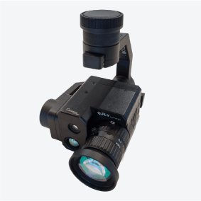
Q.Fly Explore 3CH
For: Engineers, integrators, surveillance users
Use case: SWIR capability testing, robotics, defense, environmental visibility.
Key features:
• SWIR + RGB + LWIR (thermal)
• Broadband SWIR (900–1700 nm).
• Ideal for SWIR assessment in fog/smoke, CUAV, search and rescue (S&R) scenarios
• Quick deployment, easy to use.

Advanced technical features
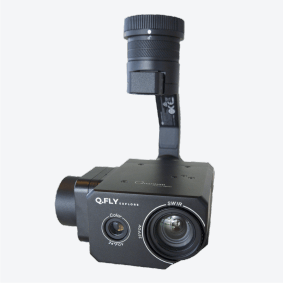
Another distinguishing feature is the high acquisition frequency of up to 220 Hz, which allows spectral images to be captured in real time with high temporal accuracy, essential for critical operations that require rapid response and quality data.
Lightweight and efficient, the system features a stabilized 3-axis gimbal weighing only about 650 g, allowing up to 35 minutes of flight time per battery cycle on compatible DJI drones.
Finally, Q.Fly Explore™ allows the use of interchangeable spectral filters, which can be quickly installed, adapting the camera to different spectral bands according to user needs, making it a complete and customizable solution for any UAV mission.
Q.Fly Explore™ stands out for its cutting-edge technology based on Quantum Dot SWIR sensors, with a VGA resolution of 640 × 512 pixels, covering a wide spectral band from 400 to 1700 nm (VIS-SWIR). This feature ensures accurate analysis beyond the visible spectrum, opening up new possibilities for applications in agriculture, security, industrial inspection, and environmental monitoring.
The Q.Fly Explore™ comes equipped with an integrated 16 MP RGB camera, ideal for georeferencing and visual positioning, as well as offering the option of a VGA thermal imager (640 × 512 px at 30 Hz), further expanding its versatility in surveillance, search and rescue missions, or thermal inspections of infrastructure.
Inside, an integrated Linux-based computer ensures full integration with DJI PSDK and Mavlink protocols, offering advanced control, task automation, and flexibility for different aerial operations.
Ideal applications by sector
Q.Fly Explore™ has been designed for multiple sectors that require accurate, reliable, and easy-to-use imaging on drones:
- Precision agriculture;
- Security and surveillance;
- Search, rescue, and fire safety;
- Industrial inspections and aerial mapping

Official announcement: INTERGEO 2024
The official launch took place at INTERGEO 2024 in Stuttgart between September 24 and 26, 2024. The event highlighted Q.Fly Explore™ as an innovative and affordable solution that is easy to integrate into DJI’s professional drones.
Competitive advantages
- Full plug-and-play with DJI: enables immediate operation without the need for complex manual integration;
- Quantum Dot technology with high spectral precision: offers wide band coverage and robust performance, more accessible than traditional InGaAs sensors;
- High frame rate and light weight: ideal for dynamic applications and extended aerial operations;
- Sophisticated automation and georeferencing: thanks to Linux and compatibility with DJI PSDK and Mavlink, as well as high-precision georeferenced spectral images.
