
")


")
")
")
")
")
DJI MATRICE 400
Engineered for Excellence, Designed for Versatility
The DJI Matrice 400, the leading corporate drone platform, features an impressive 59-minute flight time, a payload capacity of up to 6 kg, and integrated rotary and millimeter-wave LiDAR radar for powerline-level obstacle detection. It also supports O4 Enterprise enhanced video transmission and Airborne Relay video transmission, ensuring safer handling and easier operations. Combining intelligent detection with visible and thermal imaging, AR projection, ship takeoff/landing and advanced automation, the Matrice 400 excels in emergency response, power inspections, mapping and AEC.Designed for excellence, engineered for versatility.

Long flight time, high-speed performance
Payload capacity up to 6 kg
Safe and reliable flight
Improved intelligence and efficiency
Automated operations
Comprehensive accessory upgrades
DJI Care Enterprise
Long flight time, high-speed performance
The flight capabilities of the Matrice 400 are exceptional, offering up to 59 minutes of forward flight time, even with payload, and up to 53 minutes of stationary flight time. These capabilities make it a reliable tool for continuous, long-duration operations such as search and rescue, firefighting and large-scale mapping. It can also avoid large obstacles, such as buildings and mountains, at flight speeds up to 25 m/s.
Multi-payload, multi-scene
The high payload capacity of the Matrice 400 allows it to easily meet the demands of a wide range of applications. With a maximum payload capacity of 6 kg, the Matrice 400 allows seamless switching between a single downward gimbal and a dual downward gimbal. It also features a third gimbal connector on the bottom for added flexibility. The aircraft is equipped with 4 external E-Port V2 ports, allowing simultaneous mounting of up to 7 payloads.

Depending on the task, the Matrice 400 can be equipped with the Zenmuse H30, L2, P1, S1 Spotlight, V1 Speaker, Manifold 3 series or third-party payloads, expanding its capabilities and unlocking the full potential of the DJI ecosystem.

Zenmuse H30 Series
The Zenmuse H30 series integrates five main modules: a wide-angle camera, a zoom camera, an infrared thermal camera, a laser rangefinder and a NIR auxiliary light. Using state-of-the-art intelligent algorithms, it revolutionizes perception and imaging standards, transcending the limitations of day and night vision.

Zenmuse L2
The Zenmuse L2 integrates frame-based LiDAR, a self-developed high-precision IMU system and a 4/3 CMOS RGB RGB mapping camera, providing the DJI multi-cargo drone platform with more accurate, efficient and reliable geospatial data acquisition.

Zenmuse P1
The Zenmuse P1 integrates a full-frame sensor with interchangeable fixed-focus lenses on a 3-axis stabilized gimbal. Designed for photogrammetry flight missions, it takes efficiency and accuracy to a whole new level.

Zenmuse S1
The Zenmuse S1 is DJI’s first spotlight designed for drone platforms with multiple payloads. Utilizing LEP technology, it offers high brightness and long illumination range, as well as supporting multiple lighting modes. This makes it ideal for public safety, emergency rescue, inspection and other nighttime operations.

Zenmuse V1
The Zenmuse V1 is DJI’s first speaker designed for drone platforms with multiple payloads. It offers high volume and long transmission distance and supports multiple transmission modes, making it ideal for scenarios such as public safety, emergency rescue and more.

Manifold 3
Manifold 3 packs an impressive 100 TOPS of computing power into a compact unit weighing around 120g. It can be mounted on the Matrice 400 drone platform, optimizing efficiency in various operational missions with its robust processing.
Flight time
Estimate the flight time of the Matrice 400 as a function of payload configuration.

Safe and reliable flight
The Matrice 400 has an IP55 protection rating, allowing it to operate reliably in challenging conditions, including heavy dust or rain. It also maintains stable performance in temperatures from -20°C to 50°C (-4°F to 122°F), providing consistent results in hot and cold conditions.
Obstacle detection at power line level
The Matrice 400’s advanced obstacle detection system integrates rotating LiDAR sensors, high-precision mmWave radar and colorful low-light fisheye vision sensors, raising detection capabilities to unprecedented levels. The system detects even small obstacles, such as power lines in mountainous terrain, even in the dark. It can penetrate rain and fog to detect surroundings, providing increased safety in adverse weather conditions.
Robust video transmission
O4 Enterprise enhanced video transmission system
Thanks to the ten antenna system on the aircraft and the high gain phased array antenna system on the remote control, the O4 Enterprise Enhanced Video Transmission System can achieve image transmission up to 40 km.
The Matrice 400 also supports the sub2G frequency band and, when equipped with two DJI 2 Cellular Dongles, can automatically switch to the best available carrier network, providing a more stable signal even in urban interference environments or remote regions.
Airborne relay video transmission
The Matrice 400 has an integrated video relay module. With this configuration, a Matrice 400 can serve as a relay drone, flying high to provide relay signals to another Matrice 400 operating at a greater distance. This capability significantly extends the transmission range, making it ideal for search and rescue tasks as well as for inspections in mountainous areas.
Aircraft Fusion Positioning
The omnidirectional sensing performance provided by the rotating LiDAR, high-precision mmWave radar and color and low-light fisheye vision sensors gives the Matrice 400 strong positioning capabilities. It can fly stably near glass-fronted buildings or wind turbine blades and return safely from building edges, mountain bases or bridge sides, even when the return point has not been updated.
Color vision assistance
The aircraft’s four color and low-light fisheye vision sensors provide color vision assistance to ensure safer flight.
Improved intelligence and efficiency
Intelligent detection
With the visible and thermal imaging of the Zenmuse H30 series, the Matrice 400 can detect vehicles, vessels and people during search and rescue operations or routine flights. It also enables migration to other models, allowing for expanded application scenarios. In addition, it supports high-resolution grid photos and has powerful tracking capabilities.
AR power line: During tasks such as power grid inspection, the obstacle detection system automatically detects frontal obstacles and displays easily recognizable AR lines on the remote control screen, allowing you to clearly see the surrounding environment at first glance and ensuring safer flight.
AR map display: When operating during day or night in urban areas, the remote control can display the names of buildings and landmarks in real time, marking major roads with highlighted lines.
AR flight reference point: Real-time route preview is available for the drone during RTH, obstacle detection and FlyTo operations. During landing, the aircraft’s shadow can be displayed in AR to help operators confirm the landing location.
Live annotations: Without the need for modeling, you can mark points on the remote control screen to get the location of the object, draw lines to measure distances between multiple points, and outline areas to calculate their size. Measurement results can be synchronized with DJI FlightHub 2 to increase equipment efficiency.
Real-time terrain monitoring
The Matrice 400 supports real-time terrain following flight in any horizontal direction. This feature can be enabled during manual flights and automated flight paths, ensuring a stable relative altitude to the ground.
During large-scale search and rescue operations, the size of ground objects can be kept constant on the remote control display, reducing the need for frequent zoom adjustments and improving efficiency. During mapping missions, a constant ground sampling distance (GSD) can be maintained for highly accurate mapping data.
Take-off and landing on ships
To meet the needs of offshore operations such as maritime patrol and wind turbine inspection, the Matrice 400 is equipped with the ability to take off and land on ships, assisting in taking off from stationary vessels and landing on moving vessels. By detecting patterns of landing points on the deck, it can make safe and precise landings.
Improved intelligence and efficiency
- Cruise: Activate the cruise control mode to fly the drone in a specific direction without having to constantly press the control knobs, making long distance flights or linear inspections easier.
- FlyTo: In emergency or disaster situations, the drone can automatically adjust its flight path and speed based on the surrounding environment, allowing it to reach a designated location without the need for manual adjustments.
- Smart Track: Enables precise object positioning and automatic zoom adjustments, allowing easy switching between objects. It can capture an object automatically, even if it is briefly hidden.
- POI: Enables continuous observation and 3D modeling of buildings while orbiting around a designated area, which significantly increases the efficiency of fixed-point observation and modeling tasks.
Easier automated operations
Power line tracking with Zenmuse L2
Equipped with the L2 LiDAR system, the Matrice 400 can perform automated flights for tracking power transmission and distribution lines. It uses rotating LiDAR to detect obstacles in real time and automatically avoid crossing lines.
Descent route and geometric route
The Matrice 400 supports the planning and execution of geometric and descent routes using DJI Pilot 2 or DJI FlightHub 2. Whether performing detailed aerial surveys of building facades, slopes or other inclined surfaces, or collecting mapping data of individual buildings or structures, the Matrice 400 can quickly plan geometric or descent routes to acquire high-precision data efficiently.
Comprehensive accessory upgrades

DJI RC Plus 2 Enterprise Enhanced
The enhanced DJI RC Plus 2 Enterprise remote control features a new high-brightness display that remains clearly visible even in direct sunlight. It has an IP54 protection rating and can operate in temperatures ranging from -20 °C to 50 °C (-4 °F to 122 °F). Equipped with the O4 Enterprise enhanced video transmission, it has an integrated high-gain antenna array, providing robust performance. It is also compatible with the sub2G module and 4G hybrid transmission solutions, ensuring stable and smooth video transmission in both high-altitude urban and mountainous environments.

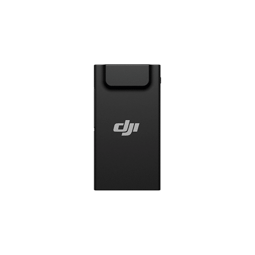
TB100 Battery
The TB100 smart flight battery uses high-performance, high-energy cells and can be charged up to 400 cycles, reducing the cost per flight. It also features improved heat dissipation and is equipped with a self-heating system for greater reliability.

BS100 Intelligent Battery Station
The intelligent battery station is a comprehensive solution for charging, storing and transporting batteries. It can charge up to three TB100 batteries and two WB37 batteries sequentially. With a fast charging time of only 45 minutes per TB100 battery, it ensures smooth and uninterrupted flight operations. In quiet mode, noise levels are as low as 36 dB.
DJI Cellular Dongle 2
The DJI Cellular Dongle 2 offers 4G network video transmission and can work together with the O4 Enterprise enhanced video transmission system, ensuring safe flights in complex environments. It also provides mobile network connectivity for remote control.

Battery with cable TB100C
The TB100C wired battery is compatible with third-party wired lighting and communication products, enabling long-lasting overhead lighting and base station communication functions via cable. Reserved ports are available to support third party development of automatic charging station products such as drone docks.
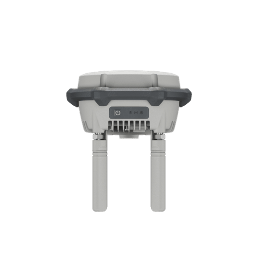
D-RTK 3 Multifunctional Station
The multifunctional D-RTK 3 can serve as a base station to provide centimeter-accurate positioning for multiple drones simultaneously. In addition, the new Rover Station mode, combined with the DJI Enterprise and DJI Terra application, provides a comprehensive solution for high-precision aerial surveying applications, ensuring accurate operations.
Software designed for industries
- DJI FlightHub 2: Specifically for the Matrice 400, DJI FlightHub 2 has been updated to enable cloud-based remote control, allowing operators to control the aircraft’s flight attitude and official payloads, as well as perform takeoffs, landings and live flight checks remotely. In addition, it supports a wide range of flight path planning functions, including slope routes, geometric routes and other advanced route types. During multi-drone operations, operators can synchronize and remotely display multiple live streams on multiple screens, creating a new and efficient integrated air-to-ground operation experience.
* Users who purchase Matrice 400 and link it to FlightHub 2 upon activation will receive allocated live streaming minutes, map image quotas and cloud storage space.
-
DJI Terra: DJI Terra is a 3D model reconstruction software that uses photogrammetry as its core technology. It enables accurate and efficient 2D and 3D reconstructions using visible light data, as well as reconstruction and processing of point cloud data with DJI Zenmuse L2. DJI Terra is the ideal complement to DJI Matrice 400 and its payloads. It works together to create a complete application solution that fits vertical scenarios such as surveying and mapping, power line inspection, emergency response, construction and forestry.
- DJI Modify: DJI Modify offers intelligent editing of 3D mesh models and point clouds. When combined with Matrice 400 and DJI Terra, it can create an integrated solution that encompasses aerial surveying, modeling, model repair and sharing.
FREQUENT QUESTIONS
AIRCRAFT
Drone Frequently Asked Questions
What is the water and dust ingress protection (IP) rating of the DJI Matrice 400? Can I fly the drone in the rain?
It has an IP55 rating. Do not fly it under rainfall greater than 100 mm/24 h.
The IP rating is not permanent and may decrease due to product wear.
What is the detection system of the DJI Matrice 400?
Omnidirectional binocular vision system.
Downward-facing binocular vision system.
LiDAR (including horizontal rotating LiDAR and upward LiDAR).
Downward-facing 3D infrared ranging sensor.
6-way mmWave radar.
How is the obstacle avoidance capability of the DJI Matrice 400?
Obstacle detection capability on power lines:
When directly facing a main line (21.6 mm steel core aluminum braided cable), obstacle detection is supported at speeds up to 25 m/s.
When both main lines (21.6 mm steel core aluminum braided cable) and distribution lines (12 mm steel core aluminum braided cable) are present, obstacle detection is supported at speeds up to 17 m/sec.
Obstacle detection performance may vary depending on environmental conditions (such as clouds, fog, rain or snow), as well as the material, position and shape of the target object.
Due to safety system limitations, the aircraft cannot actively avoid fast moving objects; fly with caution in such environments. Refer to the user’s manual for more information.
The mmWave radar function is not available in some countries/regions.
What is the payload capacity of the DJI Matrice 400?
The third gimbal connector supports a payload of up to 6 kg.
When using the single down gimbal, dual down gimbal and third gimbal connector simultaneously, the total weight of non-DJI payloads must not exceed 6 kg. Contact the payload manufacturer for a test report to ensure safe flight under low battery conditions.
Does the DJI Matrice 400 support two batteries or a single battery?
Single battery.
What is the certification level of the DJI Matrice 400 in Europe?
The DJI Matrice 400 is certified C3 by the European Aviation Safety Agency (EASA).
How do I activate the DJI Matrice 400?
When using DJI RC Plus 2 Enterprise Enhanced for the first time, connect to the Internet via Wi-Fi or smartphone hotspot, and then follow the instructions on the remote control to activate the device. After activating DJI RC Plus 2 Enterprise Enhanced, use the DJI Pilot 2 app to connect the remote control to the DJI Matrice 400 aircraft and follow the instructions on the DJI Pilot 2 app interface to activate the aircraft.
Without a 4G dongle (SIM card included), how can I use Network RTK services with DJI Matrice 400?
You can connect to Network RTK via Wi-Fi on the remote control.
Are DJI Matrice 400 Network RTK services linked to the remote control or to the aircraft?
To remote control.
Does DJI Matrice 400 support quick start?
DJI Matrice 400 features an integrated capacitor that provides backup power to critical components during battery change. If the battery change is completed within 45 seconds, the aircraft can quickly resume operation.
What payloads and accessories are compatible with DJI Matrice 400?
Gimbal cameras: Zenmuse H30, Zenmuse H30T, Zenmuse L2 and Zenmuse P1
Functional accessories: Zenmuse S1 Spotlight, Zenmuse V1 Speaker, Manifold 3, DJI RC Plus 2 sub2G SDR* module, DJI Cellular Dongle 2
RTK station: D-RTK 3 multifunctional station, D-RTK 2 mobile station
Ecosystem accessories: DJI X-Port
DJI E-Port V2 Development Kit
DJI E-Port V2 Coaxial Cable Kit
DJI SKYPORT V3 Adapter Kit
DJI SKYPORT V3 Coaxial Cable Kit
*Allowable operating frequency varies by country and region. Refer to local laws and regulations for more information.
Can I install an upward gimbal connector on the DJI Matrice 400?
No.
What mounting options does the DJI Matrice 400 support?
Supports mounting of payloads via single down, double down and third gimbal connectors.
How many payload ports does the DJI Matrice 400 have?
It has four external E-Port V2 ports. The E4 port of the E-Port V2 can be expanded to four payload ports via the E-Port HUB expansion board, allowing the DJI Matrice 400 to support up to seven payloads in total.
Does the DJI Matrice 400 have high altitude propellers?
No, high altitude propellers are not provided, but standard propellers support flights up to 7000 meters above sea level.
What types of propellers does the DJI Matrice 400 support?
Comes with standard 2510F propellers.
What are the performance advantages of having the front and rear propellers of the DJI Matrice 400 set at different heights?
Improves propulsion efficiency and increases flight stability.
Can I replace the propellers of the DJI Matrice 400 myself?
Yes, but it is only recommended in emergency situations. After the day’s operations are completed, ask the dealer to check that the propellers are properly installed and securely fastened.
What should I consider when taking off and landing the DJI Matrice 400 on a boat?
1. Reserve a flat, unobstructed 3 m × 3 m area on the deck for takeoff and landing. Make sure there is clear space above. Place the official landing spot pattern in the center, making sure its size, color, and shape match DJI’s specifications.
2. Currently, the DJI Matrice 400 supports takeoff from static craft and landing on moving craft with speeds below 10 knots.
3. During automatic landing, the aircraft may automatically climb due to a failure to recognize the landing point pattern and exit landing mode if it rises above 20 meters. If the landing point pattern is correctly recognized during climb, it will automatically re-enter the landing mode.
4. During automatic climb and landing, you can press C2 at any time to return to manual mode.
5. Do not place any payload on the bottom of the aircraft.
What precautions should be taken when using the rotating LiDAR mounted on the top of the DJI Matrice 400 aircraft?
1. Always install the protective cover on the rotating LiDAR when it is not in use.
2. If the dome becomes dirty, clean it immediately with the included cleaning cloth to ensure optimal obstacle avoidance performance.
Does DJI Matrice 400 support the relay function? How many aircraft can be relayed at the same time?
Yes, DJI Matrice 400 is compatible with the integrated relay and can provide relay function for one additional Matrice 400 aircraft at a time.
This function is not available in countries or regions that do not support the 5 GHz frequency. Please refer to local laws and regulations for more information.
Is DJI Matrice 400 compatible with D-RTK 3?
Yes.
Is DJI Matrice 400 compatible with enhanced 4G transmission?
Yes. The aircraft supports the installation of two 4G enhanced video transmission modules.
Can I use DJI Matrice 400 accessories on the DJI Matrice 350?
DJI Matrice 400 and DJI Matrice 350 accessories are not compatible with each other.
BATTERY
Battery Frequently Asked Questions
How to recharge the TB100 battery?
You can use the BS100 battery station for charging.
How long does it take to fully recharge a TB100 smart flight battery?
With a 220 V power supply: In fast charge mode, it takes approximately 45 minutes to fully recharge a DJI Matrice 400 battery. In silent mode, it takes approximately 110 minutes to fully recharge a DJI Matrice 400 battery.
With a 110 V power supply: In fast charge mode, it takes approximately 70 minutes to fully recharge a DJI Matrice 400 battery. In silent mode, it takes approximately 110 minutes to fully recharge a DJI Matrice 400 battery.
The charging time is measured in a test environment with a temperature of 25°C.
Does the DJI Matrice 400 battery support the self-heating function?
Yes.
When using the battery with the battery station: If the temperature of the TB100/TB100C battery is below 5 °C, insert the battery into the battery station and turn on the power. The battery will automatically start to warm up. Once the battery temperature exceeds 20°C, self-heating will stop and charging will start.
2. When using the battery with the aircraft: If the battery temperature is below 20°C, insert the battery into the aircraft. The battery will automatically warm up to 20°C, then it will stop warming up and enter a temperature maintenance mode.
What are the precautions for using the TB100C Battery with Anchor?
The Tethered Battery TB100C must be used with a tethered power system from a DJI ecosystem partner (tethered mode) or with a drone dock from a DJI ecosystem partner (dock mode). For specific details, please consult the respective ecosystem partner.
Can the tethered battery connection cable be used to lift the battery?
The connecting cable extending from the anchored battery is a current-carrying cable. Do not use it directly to lift the battery.
How is the shutdown resistance function implemented?
1. To use the shutdown resistor function, you can hot-swap the battery directly without the need to briefly and then long press the power button to shut down.
2. 2. If you do not want to use the extended power off function, switch off the device by briefly pressing once and then long pressing the power button.
What are the precautions when inserting or removing the battery?
1. After inserting the battery into the aircraft, make sure it is fully locked in place before pressing down on the handle. This helps prevent the handle from interfering with the pivot and potentially breaking.
2. 2. Once the WB37 battery is fully charged, press the unlock button before removing it from the battery station.
How to confirm that the battery is correctly installed?
When installing the battery in the device, press the handle down until you hear a “click”. This indicates that the handle is securely in place.
What is the function of the USB-C port?
The USB-C port can be used for both recharging and data transfer.
What are the precautions for use of the small battery?
When the WB37 battery is fully charged, press the unlock button before removing it from the battery station.
What is the maximum charging power of the BS100 battery station?
TB100 battery interface:
100-110 V AC input: 54.6 V DC output, maximum current 21.7 A
110-180 V AC input: 54.6 V DC output, max. current 27 A
180-240 V AC input: 54.6 V DC output, max. current 40 A
Remote Controller
Remote Control Frequently Asked Questions
What are the differences between DJI RC Plus 2 Enterprise and DJI RC Plus 2 Enterprise Enhanced?
The DJI RC Plus 2 Enterprise Enhanced can be equipped with the DJI RC Plus 2 sub2G SDR module, which supports sub2G communication frequency bands.
Operating frequency allowed varies among countries and regions. Refer to local laws and regulations for more information.
What does the DJI RC Plus 2 SDR sub2G module do?
The module allows the use of compatible sub2G (below 2 GHz) frequency bands, which increases the transmission range and anti-interference capability between the aircraft and the remote control.
Operating frequency allowed varies among countries and regions. Refer to local laws and regulations for more information.
Is the DJI RC Plus 2 Enterprise Enhanced remote control compatible with the Matrice 4, Matrice 4D, Mavic 3 Enterprise, Matrice 3D Enterprise and Matrice 350 RTK series?
1. It is not compatible with the Mavic 3 Enterprise, Matrice 3D Enterprise and Matrice 350 RTK series.
2. It is compatible with the Matrice 4 series and Matrice 4D series, but they must be upgraded to version 14.1 for pairing to be possible.
3. None of these drones are compatible with the sub2G communication frequency band.
Do DJI RC Plus 2 Enterprise and DJI RC Plus 2 Enterprise Enhanced support charging their batteries with third-party USB-C chargers?
Yes. To ensure optimal charging speed, we recommend using the USB-C port of the BS100 battery station or other USB-C chargers that support PD protocol and have an output power of at least 65W.
DJI RC Plus 2 Enterprise and DJI RC Plus 2 Enterprise Enhanced are compatible with MSDK?
Yes.
SOFTWARE
Frequently asked questions about software
How to update DJI Matrice 400 firmware?
The following methods can be used to upgrade the firmware:
Connect the aircraft to the computer to update the firmware of the aircraft and remote controller via DJI Assistant 2 (Enterprise Series).The following methods can be used to update the firmware:
2. Use DJI Pilot 2 to update the firmware of the aircraft, remote controller.
3. Visit the official DJI website to download the offline firmware update package for the aircraft and remote controller. Then insert the SD card that stores the firmware package into the remote controller for the offline update.
What applications are supported by DJI Matrice 400?
The DJI Pilot 2 application and other software developed through MSDK.
Is DJI Matrice 400 compatible with dual controls?
Yes.
Does DJI Matrice 400 support integration with DJI FlightHub 2 for remote control of the aircraft and DJI payloads?
Yes. DJI Matrice 400 supports remote control of flights, gimbal cameras, PSDK accessories and route-related functions via DJI FlightHub 2.
SPECS
Access to technical specifications
Aircraft
-
Takeoff Weight (with propellers)
-
Without Batteries: 5020±20 g
With Batteries: 9740±40 gActual product weight may vary due to differences in batch materials and external factors.
-
Maximum take-off weight
-
15.8 kg
-
Dimensions
-
Unfolded: 980×760×480 mm (L×W×H) (with landing gear)
Folded: 490×490×480 mm (L×W×W×H) (with landing gear and gimbal)Maximum dimensions excluding propellers.
Dimensions of the aircraft carrying case: 779×363×528 mm (L×W×H)
-
Max Payload
-
6 kg
The 6 kg payload is measured at the third gimbal connector in sea level conditions. Payload capacity decreases as altitude increases. For details, please refer to the official user manual.
-
Propeller size
-
25 inches
-
Diagonal Wheelbase
-
1070 mm
-
Maximum ascent speed
-
10 m/s
-
Maximum descent speed
-
8 m/s
-
Max Horizontal Speed (at sea level, no wind)
-
25 m/s
-
Max Takeoff Altitude
-
7000 m
-
Max Flight Time (without wind)
-
59 minutes
Measured with the aircraft flying forward at a constant speed of 10 m/s in a windless environment at sea level, carrying only the H30T (total weight 10,670 g), and from 100% battery level to 0%. Data are for reference only. Actual experience may vary depending on environment, usage and firmware version.
-
Max Hover Time (without wind)
-
53 minutes
Measured with the aircraft gliding in a windless environment at sea level, carrying only the H30T (total weight 10,670 g), and from 100% battery level to 0%. Data are for reference only. Actual usage time may vary depending on flight mode, accessories and environment.
-
Max Flight Distance (no wind)
-
49 km
Measured by the aircraft flying forward at a constant speed of 17 m/s in a windless environment at sea level, with no external payloads, and from 100% battery level to 0%. Actual experience may vary depending on environment, usage and firmware version.
-
Maximum wind speed resistance
-
12 m/s
Maximum resistance to wind speed during take-off and landing.
-
Maximum angular yaw rate
-
Yaw: 100°/s
-
Maximum pitch angle
-
35°
-
Operating temperature
-
-20° to 50° C (-4° to 122° F) (without solar radiation)
-
Global Navigation Satellite System (GNSS)
-
GPS + Galileo + BeiDou + GLONASS*.
* GLONASS is only supported if the RTK module is enabled.
Equipped with standard on-board ADS-B In receiver and dual antennas, supporting reception up to 20 km.
-
Accuracy range of hovering flight (in moderate wind or no wind)
-
Vertical:
±0.1 m (with vision positioning)
±0.5 m (with satellite positioning)
±0.1 m (with RTK positioning)Horizontal:
±0.3 m (with vision positioning)
±0.5 m (with satellite positioning)
±0.1 m (with RTK positioning)
-
GNSS RTK accuracy
-
RTK Fix:
1 cm + 1 ppm (horizontal), 1.5 cm + 1 ppm (vertical)
-
Direcction RTK
-
Supports RTK steering with an accuracy better than 2°.
-
ADS-B In airborne
-
Equipped with standard on-board ADS-B In receiver and dual antennas, supporting reception up to 20 km.
-
Internal Storage
-
N/A
-
Ports
-
USB-C debug port × 1: USB 2.0
E-Port V2 × 4: On the bottom of the drone, powered by a single 120 W port
Cellular Dongle Interface 2 × 2: On the bottom of the drone.
-
Propeller Model
-
2510F
-
Beacon
-
Built into the aircraft
-
Degree of protection against penetration
-
IP55
The rating is not permanent and may decrease due to product wear.
Gimbal
-
Maximum payload for a single gimbal connector
-
1400 g
If exceeded, the service life of the cardan damper will decrease from 1000 hours to 400 hours.
-
Maximum payload for double gimbal connector
-
950 g
-
Maximum payload for third gimbal connector
-
3 kg for quick-locking port, 6 kg for screw-locking fixture
Sensing
-
Sensing Type
-
Omnidirectional binocular vision system (surround vision provided by full-color fisheye vision sensors)
Horizontal rotating LiDAR, top LiDAR and downward 3D infrared ranging sensor
Six-direction millimeter wave radar
-
Forward
-
Measurement range: 0.4-21 m
Detection range: 0.4-200 m
Field of view (FOV): 90° (horizontal), 90° (vertical)Six-way millimeter-wave radar
-
Backward
-
Measurement range: 0.4-21 m
Detection range: 0.4-200 m
Field of view (FOV): 90° (horizontal), 90° (vertical)Six-way millimeter-wave radar
-
Lateral
-
Measuring range: 0.6-21 m
Detection range: 0.5-200 m
Field of view (FOV): 90° (horizontal), 90° (vertical)
-
Downward
-
Measuring range: 0.5-19 m
The FOV to the front and back is 160° and 105° to the right and left.
-
Operating environment
-
Forward, backward, left, right and upward:
Delicate surface texture, adequate light.Downwards:
The terrain has rich textures and sufficient lighting conditions*, with a diffuse reflective surface and a reflectivity of more than 20% (such as walls, trees, people, etc.).* Sufficient lighting conditions means an illuminance not less than that of a night scene illuminated in a city.
-
Rotating LiDAR
-
Standard measuring range: 0.5-100 m @ 100,000 lux with 10% reflectivity target
Measuring range for power line: 35 m @ 30° @ 10. 000 lux for 21.6 mm steel core aluminum braided cable with 30° relative body tilt angle left and right
Field of view (FOV): 360° (horizontal), 58° (vertical)
Dot frequency: 520,000 dots/second
Laser wavelength: 905 nm
Eye safety level: Class 1 (IEC60825-1:2014), eye-safe
-
Superior LiDAR (3D ToF)
-
0.5-25 m at night (reflectivity > 10%)
The FOV up and down is 60° and 60° to the right and left.
-
3D downward range infrared sensor
-
Measuring range: 0.3-8 m (reflectivity > 10%)
The FOV forward and backward is 60° and 60° to the right and left.
-
Millimeter wave radar
-
Power line measurement range:
36 m for 12.5 mm steel core aluminum braided cable
50 m for 21.6 mm steel core aluminum braided cable
FOV: ± 45° (horizontal and vertical)The mmWave radar function is not available in some countries/regions.
FPV camera
-
Resolution
-
1080p
-
Field of view (FOV)
-
DFOV: 150°
HFOV: 139,6°
VFOV: 95,3°
-
Image frequency
-
30fps
-
Night Vision
-
Starlight Grade
Video transmission
-
Video transmission system
-
Enhanced video transmission system DJI O4 Enterprise
-
Quality Live View
-
Remote control: 3 channels 1080p/30fps
-
Transmitter operating frequency and transmitter power (EIRP)
-
902-928 MHz: < 30 dBm (FCC), < 16 dBm (MIC)
1,430-1,444 GHz: < 35 dBm (SRRC)
2,4000-2,4835 GHz: < 33 dBm (FCC), < 20 dBm (CE/SRRC/MIC)
5,150-5,250 GHz: < 23 dBm (FCC/CE)
5,725-5,850 GHz: < 33 dBm (FCC), < 14 dBm (CE), < 30 dBm (SRRC)The permissible operating frequency varies from country to country and region to region. Refer to local laws and regulations for more information.
-
Maximum transmission distance (without obstacles or interference)
-
40 km (FCC)
20 km (CE/SRRC/MIC)Measured in an unobstructed and interference-free environment. The above data shows the farthest communication range for unidirectional flight without return according to each standard. During flight, pay attention to the RTH reminder in the DJI Pilot 2 app.
-
Max Transmission Distance (with interference)
-
Strong interferences (dense buildings, residential areas, etc.): approx. 1.5-6 km
Medium interferences (suburban counties, urban parks, etc.): approx. 6-15 km
Weak interferences (open spaces, remote areas, etc.): approx. 15-40 kmThe data has been tested in accordance with FCC regulations in typical unobstructed and interference-free environments. They are for reference only and do not guarantee actual flight distance.
-
Max Download Speed
-
Standard mode: 80 Mbps downstream
Playback download: < 25 MBps
Single-channel bitrate: ≤ 12 MbpsThe above data were measured under conditions where the aircraft and remote control were in close proximity without interference.
-
Antenna
-
WLAN antenna × 8: 6 vertically polarized antennas and 2 horizontally polarized antennas
Sub2G antenna × 2: 2 vertically polarized antennas
4G antenna × 4Operating mode: 2T4R
-
Others
-
Supports dual control mode and 2-channel cellular dongle 2
Battery
-
Model
-
TB100
-
Capacity
-
20254 mAh
-
Standard voltage
-
48.23 V
-
Maximum load voltage
-
54.6 V
-
Cell Type
-
Li-ion 13S
-
Energy
-
977 Wh
-
Weight
-
4720 ± 20 g
-
Charging Temperature
-
5° to 45° C (41° to 113° F)
-
Discharge temperature
-
-20° to 75° C (-4° to 122° F)
-
Battery heating
-
Single Battery: Support
Onboard: Compatible with
Battery Station: Support
-
Discharge rate
-
4C
-
Maximum charging power
-
2C
-
Low temperature loading
-
Supports self-heated low-temperature charging
-
Cycle Count
-
400
Intelligent battery station
-
Model
-
BS100
-
Net weight
-
11.8 kg
-
Dimensions
-
605×410×250 mm (L×W×H)
-
Compatible batteries
-
TB100 intelligent flight battery, TB100C tethered battery
WB37 battery
-
Operating temperature
-
-20° to 40° C (-4° to 104° F)
-
Input
-
100-240 V (AC), 50-60 Hz, 10 A
-
Output
-
USB-C:
TB100 battery interface:
100-110 V: Approx. 1185 W
110-180 V: Approx.1474 W
180-240 V: Approx. 2184 WBattery interface WB37:
100-240 V: Approx. 52 WUSB-C:
5.0 V 3.0 A, 9.0 V 3.0 A, 12.0 V 3.0 A, 15.0 V 3.0 A, 20.0 V 3.25 A
-
Number of load channels
-
Three TB100 and two WB37 batteries
-
Charging mode
-
Ready-to-fly mode 90%; standard mode 100%
Supports fast charge mode and silent mode
-
Charging Time
-
TB100/TB100C Battery 0% to 100%:
220 V: 45 minutes (Fast Charge Mode); 110 minutes (Quiet Mode)
110 V: 70 minutes (Fast Charge Mode); 110 minutes (Quiet Mode)The charging time is measured in a test environment with a temperature of 25°C.
DJI RC Plus 2 Enterprise Enhanced
-
Video transmission system
-
Enhanced video transmission system DJI O4 Enterprise
-
Maximum transmission distance (without obstacles or interference)
-
40 km (FCC)
20 km (CE/SRRC/MIC)Measured in an unobstructed and interference-free environment. The above data shows the farthest communication range for unidirectional flight without return according to each standard. During flight, pay attention to the RTH reminder in the DJI Pilot 2 app.
-
Video transmission operating frequency and transmitter power (EIRP)
-
902-928 MHz: < 30 dBm (FCC), < 16 dBm (MIC)
2.400-2.4835 GHz: < 33 dBm (FCC), < 20 dBm (CE/SRRC/MIC)
5.150-5.250 GHz: < 23 dBm (FCC/CE)
5.725-5.850 GHz: < 33 dBm (FCC), < 14 dBm (CE), < 30 dBm (SRRC)The permissible operating frequency varies from country to country and region to region. Refer to local laws and regulations for more information.
-
Antenna
-
2T4R, 2.4 GHz/5.8 GHz high gain multibeam antenna
sub2G module: 2T2R
-
Improved transmission
-
Compatible with DJI Cellular Dongle 2
-
Wi-Fi Protocol
-
Wi-Fi Direct, Wireless Display, IEEE 802.11 a/b/n/ac/ax
Supports Wi-Fi MIMO 2×2, dual simultaneous dual band (DBS) for dual MAC, with data rates up to 1774.5 Mbps (2×2 + 2×2 + 2×2 11ax dual simultaneous dual band)
-
Wi-Fi operating frequency
-
2,4000-2,4835 GHz
5,150-5,250 GHz
5,725-5,850 GHzThe 5.2 and 5.8 GHz frequencies are prohibited in some countries. In some countries, the 5.2 GHz frequency is only allowed indoors.
-
Wi-Fi Transmitter Power (EIRP)
-
2.4 GHz: < 26 dBm,< 20 dBm (CE/SRRC/MIC).
5.1 GHz: < 23 dBm (FCC/CE/SRRC/MIC).
5.8 GHz: < 23 dBm (FCC/SRRC), < 14 dBm (CE).
-
Bluetooth Protocol
-
Bluetooth 5.2
-
Bluetooth operating frequency
-
2.400-2.4835 GHz
-
Bluetooth Transmitter Power (EIRP)
-
< 10 dBm
-
Screen Resolution
-
1920 × 1200
-
Screen size
-
7.02 inches
-
Screen frame rate
-
60fps
-
Brightness
-
1400 nits
-
Touch screen control
-
10-point Multi-Touch
-
Built-in Battery
-
2S2P high energy density 18650 lithium-ion battery (6500 mAh @ 7.2 V) 46.8 Wh
-
External Battery
-
Optional, WB37 (4920 mAh @ 7.6 V) 37 Wh
-
Charging type
-
Supports fast PD charging, with a maximum 20V/3.25A USB Type-C charger.
-
Storage Capacity
-
RAM 8G + ROM 128G UFS + expandable storage via microSD card
-
Charging Time
-
2 hours for internal battery; 2 hours for internal plus external battery.
When the remote control is turned off and using a standard DJI charger.
-
Internal battery life
-
3.8 hours
-
External Battery Runtime
-
3.2 hours
-
Output Port
-
HDMI 1.4
-
Indicators
-
Status LED, battery level LED, connection status LED, tri-color light, brightness adjustable according to ambient light.
-
Speaker
-
Supports doorbell
-
Audio
-
MIC Array
-
Operating temperature
-
-20° to 50° C (-4° to 122° F)
-
Storage Temperature
-
Within one month: -30° to 45° C (-22° to 140° F)
One to three months: -30° to 35° C (-22° to 113° F)
Three months to one year: -30° to 30° C (-22° to 86° F)
-
Charging Temperature
-
5° to 40° C (41° to 104° F)
-
Supported aircraft model
-
Matrice 400
-
Global Navigation Satellite System
-
GPS + Galileo + BeiDou
-
Dimensions
-
268×163×94.5 mm (L×W×H)
Width including folded external antenna, thickness including handle and control sticks.
-
Weight
-
1.15 kg (without external battery)
-
Model
-
TKPL 2
-
System Version
-
Android 11
-
External Interfaces
-
HDMI 1.4, SD 3.0, USB-C with OTG support, max. 65W PD charging, USB-A with USB 2.0 support
-
Accessories
-
Strap/waist support
Compatible products
-
DJI products compatible with Matrice 400
-
Gimbal Cameras: Zenmuse H30, Zenmuse H30T, Zenmuse L2 and Zenmuse P1
Accessories: Zenmuse S1 (drone light), Zenmuse V1 (drone speaker), Manifold 3, DJI RC Plus 2 sub2G SDR Module, DJI Cellular Dongle 2
RTK Station: D-RTK 3 Multifunction Station, D-RTK 2 Mobile Station
Ecosystem accessories: DJI X-Port
DJI E-Port V2 Development Kit
DJI E-Port V2 Coaxial Cable Kit
DJI SKYPORT V3 Adapter Set
DJI SKYPORT V3 Coaxial Cable Kit
