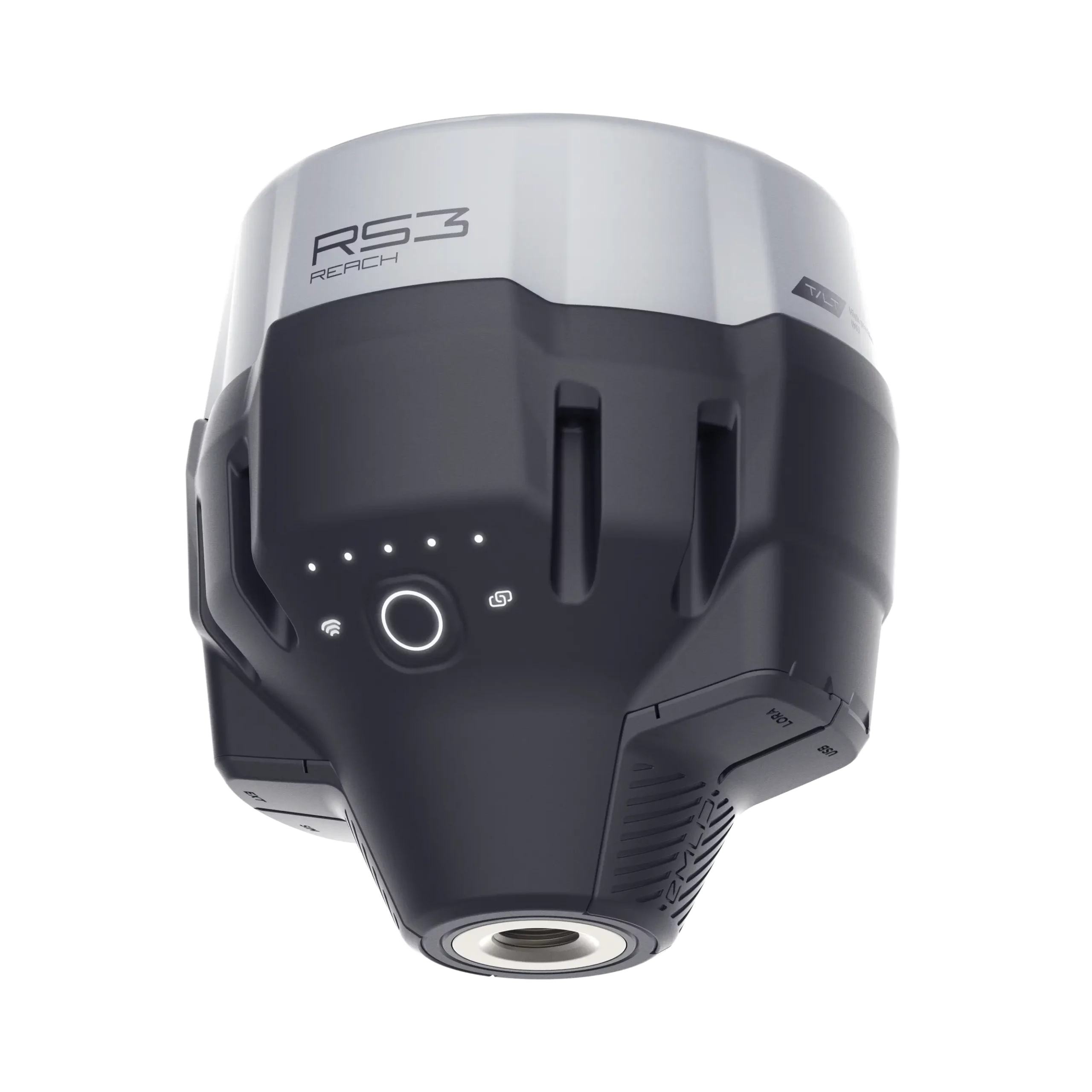
REACH RS3
GNSS RTK receiver with tilt compensation.
Topographic level accuracy, even in hard-to-reach places.
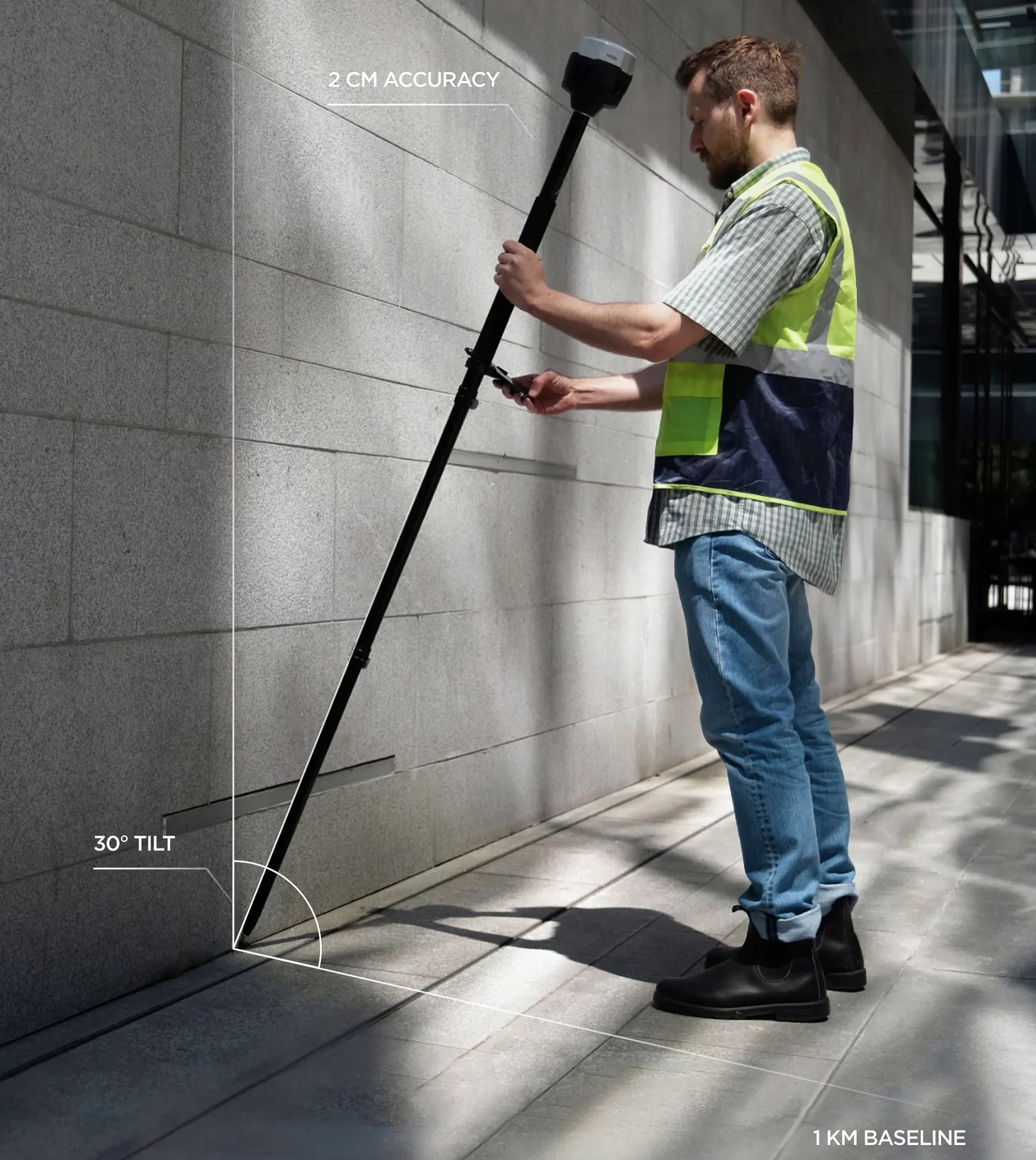
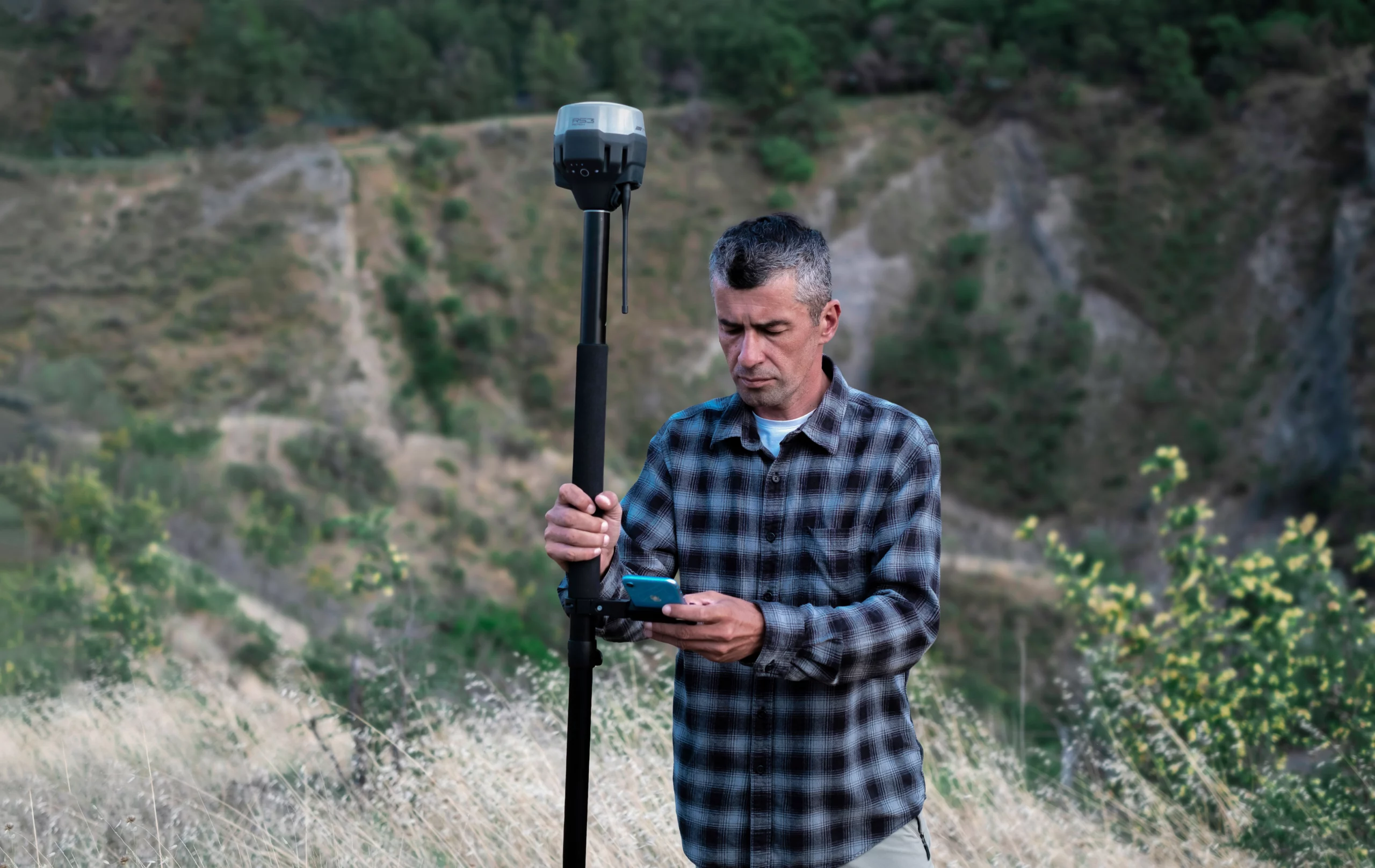
Accurate results even at large tilt angles
The IMU-based tilt compensation in Reach RS3 allows you to perform measurements with up to 60 degrees of tilt while maintaining an accuracy of 20 mm.
Reach RS3 continuously measures and corrects tilt in real time to keep you on target.
Inspect and stake out faster
It is not necessary to check the bubble.
Robust and effortless IMU inclination compensation
- No calibration – We calibrate the inertial measurement unit of each device individually at the factory, so you can get your Reach RS3 up and running right out of the box.
- Immune to magnetic disturbances – The RS3’s GNSS and IMU sensors are unaffected by magnetic fields and provide robust tilt compensation even when working close to metallic structures.
- Quick initialization – Initialization of the tilt requires about 20 meters of walking or 10 to 20 seconds of tilt. It is usually ready on the way from the car.
Fast and reliable GNSS receiver
Obtains a solution in 5 seconds
RINEX logging and PPP support
Record raw data in RINEX format for post-processing. You can use our free PPK software, Emlid Studio or any other RINEX-compatible software. The logs are also compatible with OPUS, AUSPOS and PPP services, so you can get very accurate results anywhere in the world.
Up to 22 hours on 1 charge
Built-in LTE modem
Get corrections from CORS, Reach or third-party databases
Base and Rover NTRIP
You can also connect another GNSS receiver as an NTRIP base using Emlid NTRIP Caster.
Any receiver with RTCM3 support.
Base and mobile LoRa 868/915 MHz
- Perfect for areas without Internet coverage for NTRIP. LoRa is used when connecting Emlid GNSS receivers via radio.
Compatibility
All Emlid receivers with built-in radio.
UHF 450 MHz Mobile Radio Transmitter
An option for combining RTK receivers within your fleet. You can configure your Reach RS3 to receive corrections from an existing base*.
You can also use an external high power radio in your Reach base and connect it to the UHF radio receiver in Reach RS3.
Compatibility
Bases with TRIMTALK 450S transmitting radios.
Comes with software for the field and office.
Emlid Flow efficiently manages all field-related tasks, including receiver setup, RINEX logging, data collection and stakeout.
The basic functions are available free of charge to all users. Upgrade your Emlid Flow and Flow 360 with a single subscription.
+ Tilt compensation
+ Base and rover configuration
+ Coding
+ Points, lines and polygons
+ Inverse and transverse
+ WMS layers
+ DTM support
+ Stakeout reports
+ CSV, DXF, SHP and KML
You can access your survey data through the cloud-based Emlid Flow 360. It allows you to prepare, manage and export your projects from a browser.
The basic functions are available free of charge to all users. Upgrade your Emlid Flow and Flow 360 with a single subscription.
+ Prepare and manage projects
+ Share data instantly between the field and the office
+ Always have a backup of your work
Our free post-processing software for macOS and Windows.
Learn more about Emlid Studio here .
+ Kinematic processing
+ Static processing
+ RTK Drone Data Processing
+ Raw data analysis
+ Stop and Go with Emlid Flow
Connect up to 10 rovers to your base station via the Internet or set up your own NTRIP network with Emlid Caster.
Learn more about Emlid Caster here .
+ Available free of charge and works worldwide.
+ Works with Reach and other receivers with NTRIP support.
+ Compatibility with RTCM3 and other correction formats
+ Up to 5 bases and 10 rovers at the same time
Robust and compact
126 x 126 x 142 mm
950 gramas
IP67
The RS3 is water resistant to a depth of up to one meter. Silicone plugs provide a complete seal and protect all connectors from water and dust .
-20 a +65 ºС
We extensively tested Reach RS3 in conditions that simulate the coldest winters and hottest summers.
Industrial battery
The Reach RS3 lithium-ion battery withstands high and low temperatures well and over 2000 charge/discharge cycles while maintaining its original capacity.
While others replace the batteries hot, the Reach GNSS receiver keeps working.
Impact resistant
The body of the Reach RS3 GNSS receiver is impact and drop resistant and prepared for the harshest conditions.
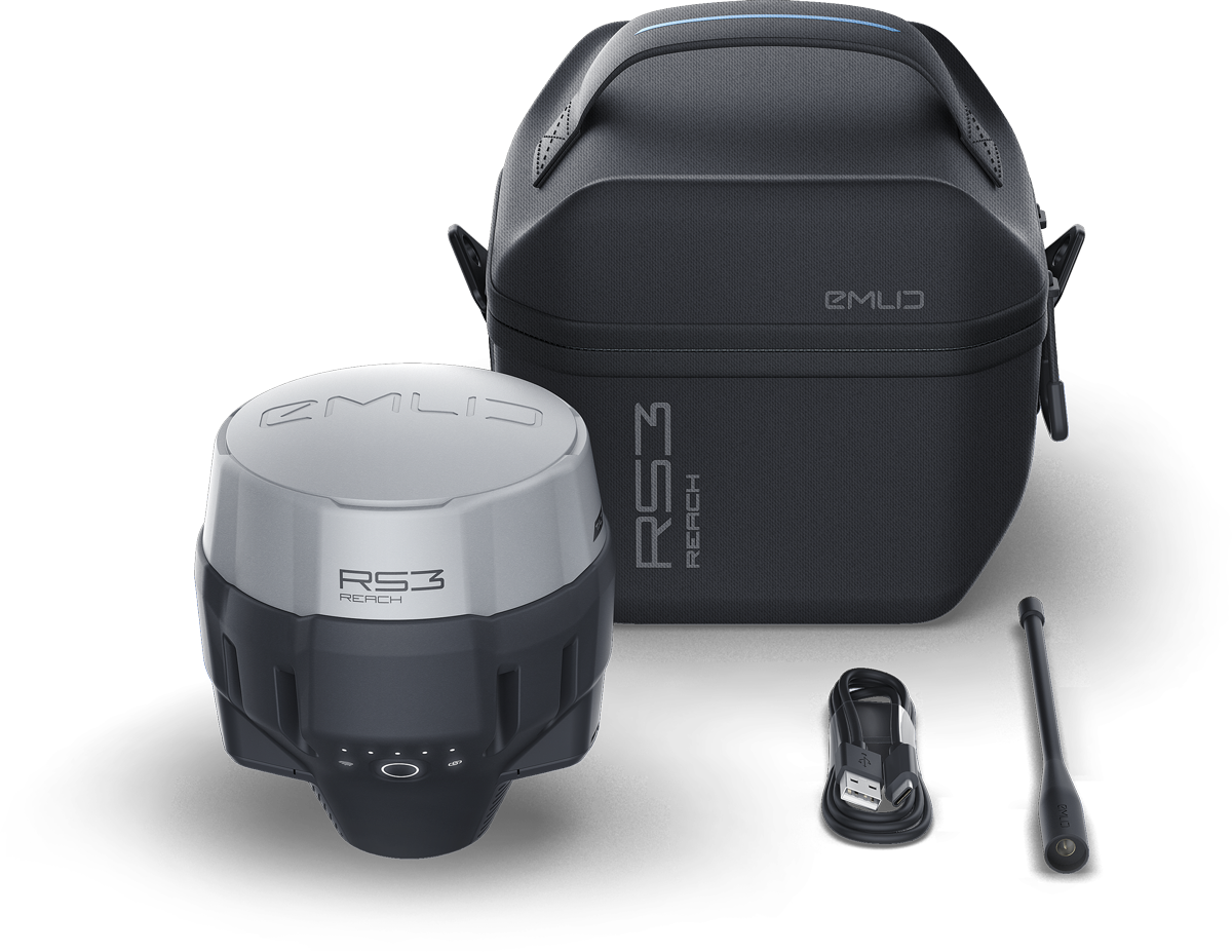
In the package
- RS3 Range
- LoRa Antenna
- USB cable
- Carrying case with strap
SPECS
Specs Reach RS3
Mechanical
| Dimensions | 126 x 126 x 142 mm |
| Weight | 950 g |
| Operating tº | -20 to +65 ºC |
| Ingress Protection | IP67 |
Eletrical
| Autonomy | 18 hours as RTK rover with tilt 22 hours logging |
| Battery | Battery 5200 mAh, 7.2 V lithium-ion battery, 37.44 Wh |
| Charging | USB type C 5 V, 3 A |
Positioning
| Static | Horizontal: 4 mm + 0.5 ppm Vertical: 8 mm + 1 ppm |
| PPK | Horizontal: 5 mm + 0,5 ppm Vertical: 10 mm + 1 ppm |
| RTK | Horizontal: 7 mm + 1 ppm Vertical: 14 mm + 1 ppm |
| Inclination | RTK + 2 mm + 0,3 mm/° |
| Convergence time | ~5 s normally |
Connectivity
| Radio LoRa Frequency range Power Distance |
Transmit and receive 868/915 MHz 0,1 W Up to 8 km |
| *UHF Frequency range Protocols Modulation type |
Receive only 410-470 MHz TRIMTALK 450S** GMSK |
| Módem LTE |
Global Regional bands SIM tariff – Nano SIM |
| Wifi | 802.11b/g/n |
| Bluetooth | 4.0/2.1 EDR |
| Ports | RS-232, USB type C |
*Requires a 410-470 MHz antenna, sold separately.**TRIMTALK is a trademark of Trimble Inc.
Data
| Corrections | NTRIP, RTCM3 |
| Position output | NMEA, LLH/XYZ |
| Data logging | RINEX, NMEA, LLH/XYZ, UBX |
| Internal storage | 16 GB |
Global Navigation Satellite System (GNSS)
| Tracked signal | GPS/QZSS L1C/A, L2C, GLONASS L1OF, L2OF, BeiDou B1I, B2I, Galileo E1B/C, E5b |
| Number of channels | 184 |
| Update tariffs | up to 10 Hz |
| Intramuscular measuring unit (IMU) | 6 degrees of freedom |

