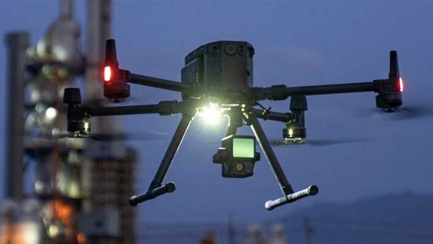
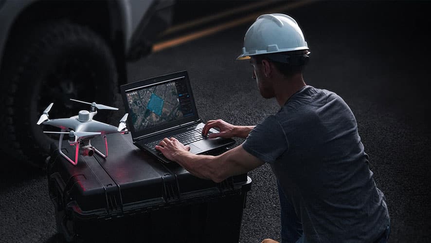
MAVIC 2 ENTERPRISE ADVANCED
Precise detail on any mission
Mavic 2 Enterprise Advanced vs Dual vs Zoom
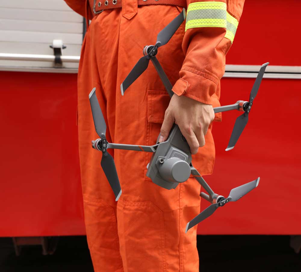
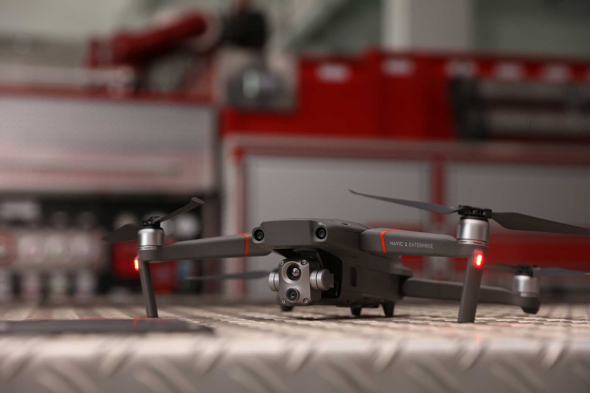
The M2EA is perfect for firefighting, search and rescue, law enforcement, energy inspection and environmental protection. It has high quality visual, thermal, zoom and RTK features.
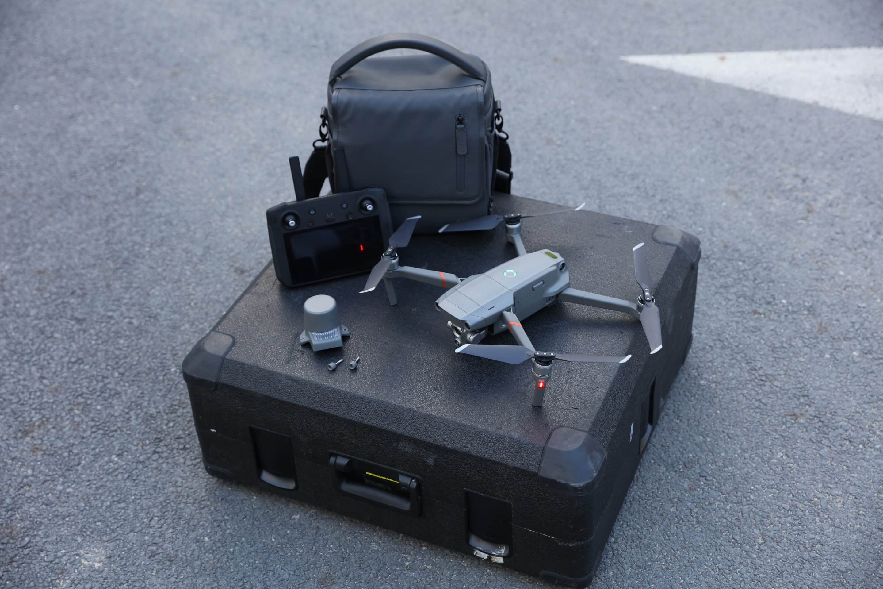
Higher resolution camera: The M2EA has a 48MP visual sensor compared to Dual and Zoom’s 12MP camera.
Better thermal sensor:640 x 512 px thermal resolution, at 30 Hz. The M2EA can store thermal images as R-JPEG. This sensor has a 16x digital zoom.
More powerful zoom: The M2EA has a digital zoom of up to 32x.
RTK module: Can be integrated into the M2EA, providing centimetric positioning.
Waypoints: The M2EA can generate up to 240 waypoints, allowing complex automated missions.
KEY FEATURES
Now you can capture precise details on any mission with the Mavic 2 Enterprise Advanced.
- Thermal and RGB Sensors:: A 48MP RGB sensor coupled with a high-resolution 640 x 512 radiometric thermal camera make this drone the most versatile drone on the market. The high quality dual sensor means it can collect more accurate data at the same time.
- Centimetre-level positioning with RTK: More precise operations, even in the most challenging environments. (RTK module optional).
- Advanced digital zoom: M2EA supports up to 32x digital zoom. This allows for more accurate temperature measurement collection and more detailed visual data at a safe distance. The thermal camera has up to 16x digital zoom.
- Data security: private, secure and confidential flights.
- Broad compatibility
- Additional features: MSDK; AirSense; Password protection; Discreet mode; Spontaneously heating batteries; Working temperature -10°C to 40°C.
APPLICATIONS
– Fire fighting;
– Search and rescue;
– Structural inspections;
– Law enforcement;
– Surveying
– Energy inspection;
– Environmental protection.
ACCESSORIES
Stay on mission longer with commercial accessories

RTK module
It supports NTRIP and can provide centimeter positioning accuracy.
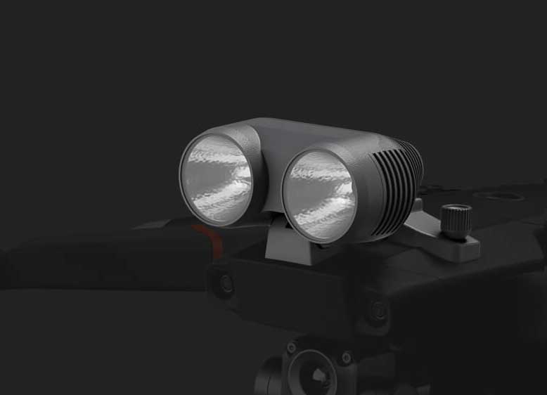
Focus
Illuminates the way in night operations or in low light conditions.
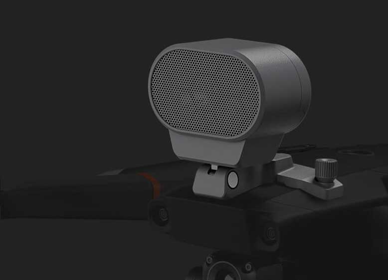
Speaker
Stores multiple voice recordings and clips. Allows the command center to communicate with teams during emergencies
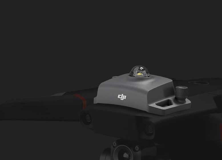
Beacon
Indicates the location of the aircraft at night to comply with night operations regulations. Range up to 5 km.
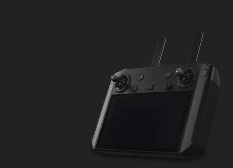
DJI Smart Controller
5.5-inch display with clear visibility even in direct sunlight. Pre-installed DJI Pilot application. Supports third-party applications for customized solutions.

Mavic 2 Enterprise Fly More Kit
Kit adicional que consta de 2 baterías empresariales, 2 pares de hélices, centro de carga, powerbank y estuche de transporte. Useful and affordable.
FREQUENT QUESTIONS
AERONAVE
Drone Frequently Asked Questions
AERONAVE
Does the M2EA visual camera have an optical zoom?
No, the M2EA’s visual camera has a 32x digital zoom.
Does the M2EA support camera switching? Can you switch the camera to use the camera of an M2E series drone?
Currently, it is not possible to change the camera.
When the M2EA is on a trajectory mission, a mapping mission or an oblique mission, will the thermal camera also capture photos?
Yes. During these missions, two types of images (visual and thermal) will be stored on the SD card.
What is the difference between M2E Advanced and M2E Dual?
M2EA is optimized for rapid implementation in different industry applications. La resolución térmica se ha mejorado a 640×512 px, y la resolución de la cámara visual es 4 veces mejor que la del M2E Dual. In addition to the new RTK module, flight performance and trajectory missions have also been optimized on the M2EA.
Is the M2EA waterproof?
No. Don’t fly if it’s raining.
REMOTE CONTROL
Frequently Asked Questions about Remote Control
Can the Mavic 2 Enterprise or Mavic 2 Enterprise Dual remote control be used with the Mavic 2 Enterprise Advanced (M2EA)?
The DJI Smart Controller is compatible with all three models. However, the remote control (without display) of the M2E/M2ED is not compatible with M2EA.
SOFTWARE
Software Frequently Asked Questions
Which application is compatible with the Mavic 2 Enterprise Advanced?
DJI Pilot (Android version) and third-party apps developed with DJI MSDK.
Can I measure the temperature in the thermal images captured with the M2EA during post-processing?
Yes. More information about the post-processing software will be published soon.
How many benchmarks can I set in a mission?
After optimizing the Path missions, you can set up to 240 waypoints.
¿Será M2EA compatible con la versión iOS de DJI Pilot?
No.
Can I add a time stamp to photos taken with the M2EA?
Yes, although this is only possible in visible light photos.
How do I update the firmware in the M2EA?
- Connect to a computer and use DJI Assistant 2 for Mavic to update the aircraft and remote control firmware.
- Run the updates in the DJI Pilot application.
Is FlightHub compatible with M2EA?
No.
Can I use M2EA for aerial surveying?
M2EA is not specifically designed to meet the accuracy requirements of aerial surveying, but you can use visible light or infrared cameras to capture images for mapping missions in the DJI Pilot app.
ACCESSORIES
Frequently Asked Questions about Accessories
Which Mavic 2 Enterprise series accessories are compatible with the M2EA?
The protective case, speaker, spotlight, beacon, accessory port cover, accessory bag, batteries, propellers, chargers and charging station can be used with the Mavic 2 Enterprise series.
With the RTK module installed, does the M2EA fit in the protective case?
Yes.
Is the M2EA’s RTK module compatible with the Mavic 2 Enterprise and Mavic 2 Enterprise Dual?
The RTK module is only compatible with the M2EA, and does not support the use with the M2E or M2ED.
Is PPK supported on the M2EA?
No.
Can the M2EA be used with the D-RTK 2 Mobile Station for the Phantom 4 RTK or for the Matrice Series?
The M2EA is currently not compatible with the D-RTK 2 Mobile Station. Please connect to an NTRIP network.
SPECS
Access to technical specifications
|
Takeoff Weight (Without Accessories)
|
909 g
|
|
Max. take-off weight
|
1100 g
|
|
Dimensions (L×W×H): |
Folded: 214×91×84mm Unfolded: 322×242×84mm Unfolded+Spotlight: 322×242×114mm Unfolded+Beacon: 322×242×101mm Unfolded+Speaker: 322×242×140mm Unfolded+RTK Module: 322x242x125mm
|
|
Diagonal Distance
|
354 mm
|
|
Max Ascent Speed
|
6 m/s (S-mode) 5 m/s (P-mode) 4 m/s (S-mode with accessories) 4 m/s (P-mode with accessories)
|
|
Max Descent Speed
|
Descend Vertically 5 m/s (S-mode) 4 m/s (P-mode) Tilt 7 m/s (S-mode) 4 m/s (P-mode)
|
|
Max Speed
|
72 kph (S-mode, without wind) 50 kph (P-mode, without wind)
|
|
Max Service Ceiling Above Sea Level
|
6000 m
|
|
Max. flight time
|
31 min (measured while flying at 25 kph in windless conditions) 28 min (RTK module attached) 29 min (with beacon turned on) 30 min (with beacon turned off) 24 min (with spotlight turned on) 28 min (with speaker turned off) 27 min (with speaker turned on) 28 min (with speaker turned off)
|
|
Max Wind Resistance
|
10 m/s (scale 5)
|
|
Max Tilt Angle
|
35°(S-mode, with remote controller) 25°(P-mode)
|
|
Max. angular speed
|
200°/s (S-mode) 100°/s (P-mode)
|
|
Operating temperature
|
−10 a 40 °C
|
|
GNSS
|
GPS + GLONASS
|
|
Hovering Accuracy Range
|
Vertical: ±0.1 m (with RTK) ± 0.1 m (with Vision Positioning) ±0.5 m (with GPS Positioning) Horizontal: ±0.1 m (with RTK) ±0.3 m (with Vision Positioning) ±1.5 m (with GPS Positioning)
|
|
Operating Frequency
|
2.400-2.4835 GHz 5.725-5.850 GHz
|
|
Transmitter Power (EIRP)
|
2.400-2.4835 GHz FCC: ≤26 dBm; CE: ≤20 dBm; SRRC: ≤20 dBm; MIC: ≤20 dBm 5.725.5.850 GHz FCC: ≤26 dBm; CE: ≤14 dBm; SRRC: ≤26 dBm
|
|
Internal Storage
|
24 GB
|
M2EA Thermal Camera
Sensor |
Uncooled VOx Microbolometer
|
Focal Length
|
Aprox. 9 mm 35 mm format equivalent: Approx. 38 mm
|
Sensor Resolution
|
640×512 a 30 Hz
|
Scene Range
|
-40 °C to 150 °C (High Gain) -40 °C to 550 °C (Low Gain)
|
Digital Zoom
|
16×
|
Pixel Pitch
|
12 μm
|
Spectral Band
|
8-14 μm
|
Photo Format
|
R-JPEG
|
Video Format
|
MP4
|
Metering Method
|
Spot Meter, Area Measurement
|
FFC
|
Auto/Manual
|
M2EA Visual Camera
Sensor
|
CMOS de 1/2”. Effective Pixels: 48 M
|
Lens
|
FOV: 84° 35 mm format equivalent: 24 mm Aperture: f/2.8 Focus: 1 m to ∞
|
ISO Range
|
Video: 100-12800 (auto) Photos: 100-1600 (auto)
|
Digital Zoom
|
32×
|
Max Image Size
|
8000 × 6000
|
Still Photography Modes
|
Single shot: Interval: 2/3/5/7/10/15/20/30/60 s Panorama: Sphere
|
Video Resolution
|
3840×2160 a 30 fps 1920×1080 a 30 fps
|
Photo Format
|
JPEG
|
Video Format
|
MP4
|
Gimbal
Mechanical Range
|
Tilt: -135°- +45° Pan: -100°- +100°
|
Controllable Range |
Tilt: -90°- +30° Pan: -75°- +75° |
Stabilisation
|
3-axis (tilt, roll, pan)
|
Max control speed
|
120°/s
|
Angular Vibration Range
|
±0.005°
|
Sensing System
Sensing System
|
Omnidirectional Obstacle Sensing
|
Forward
|
Precision Measurement Range: 0.5 – 20 m Alcance de detección: 20-40 m Effective Sensing Speed: ≤ 14m/s FOV: Horizontal: 40°, Vertical: 70°
|
Backward
|
Precision Measurement Range: 0.5 – 16 m Detectable Range: 16 – 32 m Effective Sensing Speed: ≤ 12m/s FOV: Horizontal: 60°, Vertical: 77°
|
Upward
|
Precision Measurement Range: 0.1-8 m
|
Downward
|
Precision Measurement Range: 0.5 -11m Detectable Range: 11-22 m
|
Sides
|
Precision Measurement Range: 0.5 – 10 m Effective Sensing Speed: ≤ 8m/s FOV: Horizontal: 80°, Vertical: 65°
|
Operating Environment
|
Forward, Backward and Sides: Surface with clear pattern and adequate lighting (lux >15) Upward: Detects diffuse reflective surfaces (>20 %) (walls, trees, people, etc.) Downward: Surface with clear pattern and adequate lighting (lux >15) Detects diffuse reflective surfaces (>20 %) (walls, trees, people, etc.)
|
Remote Controller
Operating Frequency
|
2.400-2.483 GHz; 5.725-5.850 GHz
|
Max. transmission distance (unobstructed, free of interference)
|
2.400-2.483 GHz; 5.725-5.850 GHz FCC: 10 000 m CE: 6000 m SRRC: 6000 m MIC: 6000 m
|
Transmission Power (EIRP)
|
2.400-2.4835 GHz: 25.5 dBm (FCC); 18.5 dBm (CE) 19 dBm (SRRC); 18.5 dBm (MIC) 5.725-5.850 GHz: 25.5 dBm (FCC); 12.5 dBm (CE) 18.5 dBm (SRRC)
|
Storage
|
ROM 16GB + microSD Extensible Storage
|
Video Output Port |
HDMI Port
|
Built-in Battery
|
Type: 18650 Li-Po (5000 mAh @ 7.2 V) Charging Mode: Charged with USB charger at 12V/2A Rated Power 15 W Charging time: 2 hr (with a USB charger at 12V/2A)
|
Charging time
|
1800 mA ⎓ 3.83 V
|
Battery Life
|
Integrated battery approx. 2.5 h
|
Operating temperature
|
−20 a 40° C
|
Remote control size
|
Folded without control levers: 177.5 × 121.3 × 40 mm Unfolded with control levers: 177.5 × 181 × 60 mm
|
Weight
|
Aprox. 630 g
|
Intelligent Flight Battery
|
Main connection: 17.6 V ⎓ 3.41 A or 17.0 V ⎓ 3.53 A USB: 5.0 V ⎓ 2.0 A
|
RTK MODULE
Dimensions
|
69 × 69 × 59 mm
|
Connections
|
Micro-USB port
|
RTK Positioning Accuracy
|
In RTK FIX 1 cm + 1 ppm (horizontal) 1.5 cm + 1 ppm (vertical) |
FOCUS M2EA
Dimensions
|
68 × 60 × 41 mm
|
Connections
|
Micro-USB port
|
Operating range
|
30 m
|
Power
|
Máx. 26 W
|
Illuminance
|
FOV 17°, max: 11 lux at 30 m direct
|
INTELLIGENT BATTERY FOR FLIGHT
Capacity
|
3850 mAh
|
Voltage
|
15.4 V
|
Max. load voltage
|
17.6 V
|
Battery type
|
LiPo
|
Energy
|
59.29 Wh
|
Net weight
|
297 g
|
Charging time
|
From 5 to 40 °C
|
Operating temperature range
|
−10 a 40 °C
|
Heating methods
|
Manual heating; Self-heating
|
Heating temperature
|
From −20 to 6 °C |
Duration of warm-up
|
500 s (máx.)
|
Heating power
|
55 W (máx.)
|
Charging time
|
90 min
|
Max. load power
|
80 W
|
BEACON M2EA
Dimensions
|
68 × 40 × 27.8 mm |
Connections
|
Micro-USB port
|
Power
|
Media 1.6 W
|
Controllable Range
|
5000 m
|
Light intensity
|
Min. angle: 55 cd; Light intensity: 157 cd
|
APLICACIÓN/RETRANSMISIÓN EN DIRECTO
Video transmission system
|
OcuSync 2.0
|
Mobile application
|
DJI PILOT (Android version)
|
Quality of the live broadcast
|
720p a 30 fps
|
Max. live video bit rate
|
40 Mbps
|
Latency
|
120-130 ms
|
Operating system required
|
iOS 10.0 or later, Android 5.0 or later
|
SD CARDS
Supported SD cards
|
MicroSD™ Compatible with microSD cards with capacity up to 128 GB. A UHS-I microSD card with a speed grade 3 is required. |
OTHERS
Footnotes
|
1] Omnidirectional obstacle detection encompasses front, rear, top, bottom, left and right obstacle detection. Left and right detection are only available in Tripod mode. Omnidirectional obstacle detection does not cover the entire circumference around the drone. Left and right obstacle detection only works in specific modes and environments. DJI’s warranty does not cover losses caused by collisions when flying sideways, even if the Tripod mode is activated. To ensure the safety of your flight, always remain alert and attentive to your surroundings and the application’s notifications when flying an M2EA. |

